


Mining Basins Route
-
Length: Approx. 406 km
-
Provinces included: León, Palencia
-
Total ascent: 10,432 m
-
Total descent: 10,760 m
-
Maximum altitude: 1,688 mMinimum altitude: 474 m
- Minimum altitude: 474 m
Track:
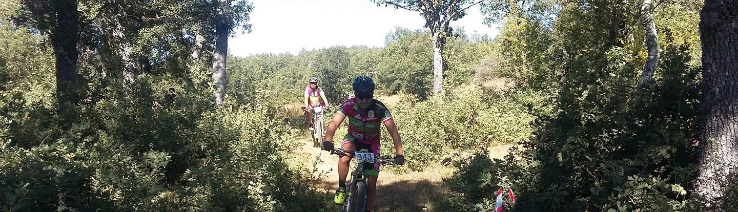
This route will allow you to discover Castilla y León’s valuable industrial mining heritage, as well as the beautiful landscapes that it passes through. The route crosses the provinces of León and Palencia, the only provinces in Castilla y León that are home to coal mining. There are a total of 60 Sites of Cultural Interest on this route.
The main route (known as route 1: Barruelo de Santullán – Balboa) crosses Palencia and León’s northern mining regions from east to west, with a total of over 400 km of the route divided into 13 stages, of about 25-30 km each.
There are other signposted routes linked to the main route that will take you to other mining towns and valleys: Route 2: Cistierna – Crémenes; Route 3: Mudá – San Cebrián de Mudá; Route 4: Riello – Villablino; and Route 5: Cueto – Fabero.
These routes combine forest tracks with stretches of mainly secondary roads. Of the nine routes described here, this is the most suitable one for mountain bikes due to the terrain and paths that make up this route. This route is fully signposted (IMBA España).
More information: www.turismocastillayleon.com/en/countryside-nature/castilla-leon-bicicleta/coal-mining-basins-route
Tracks Ruta por las Cuencas mineras del carbón (201.5 KB)