Ojo Guareña Natural Monument
Image gallery
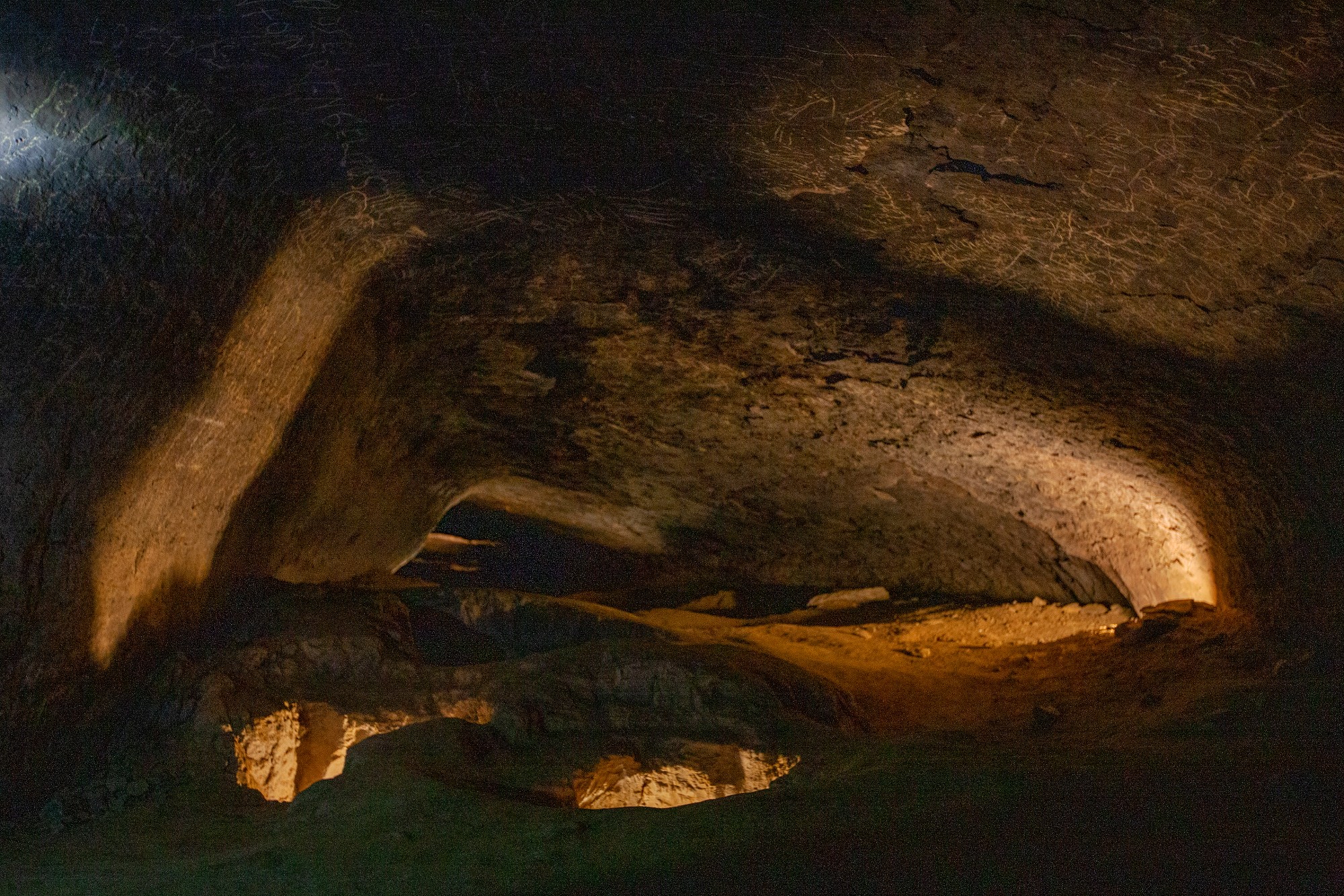
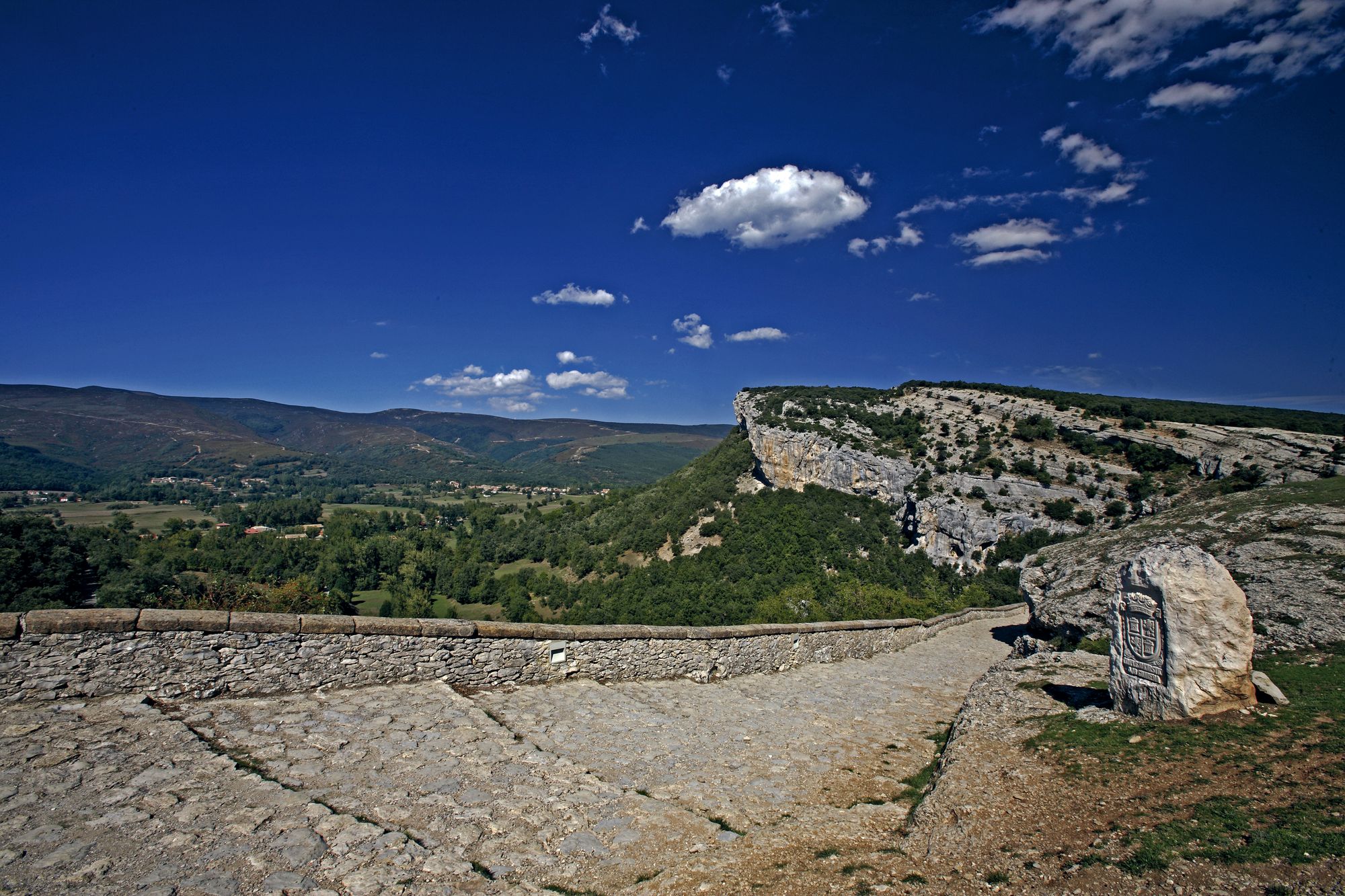
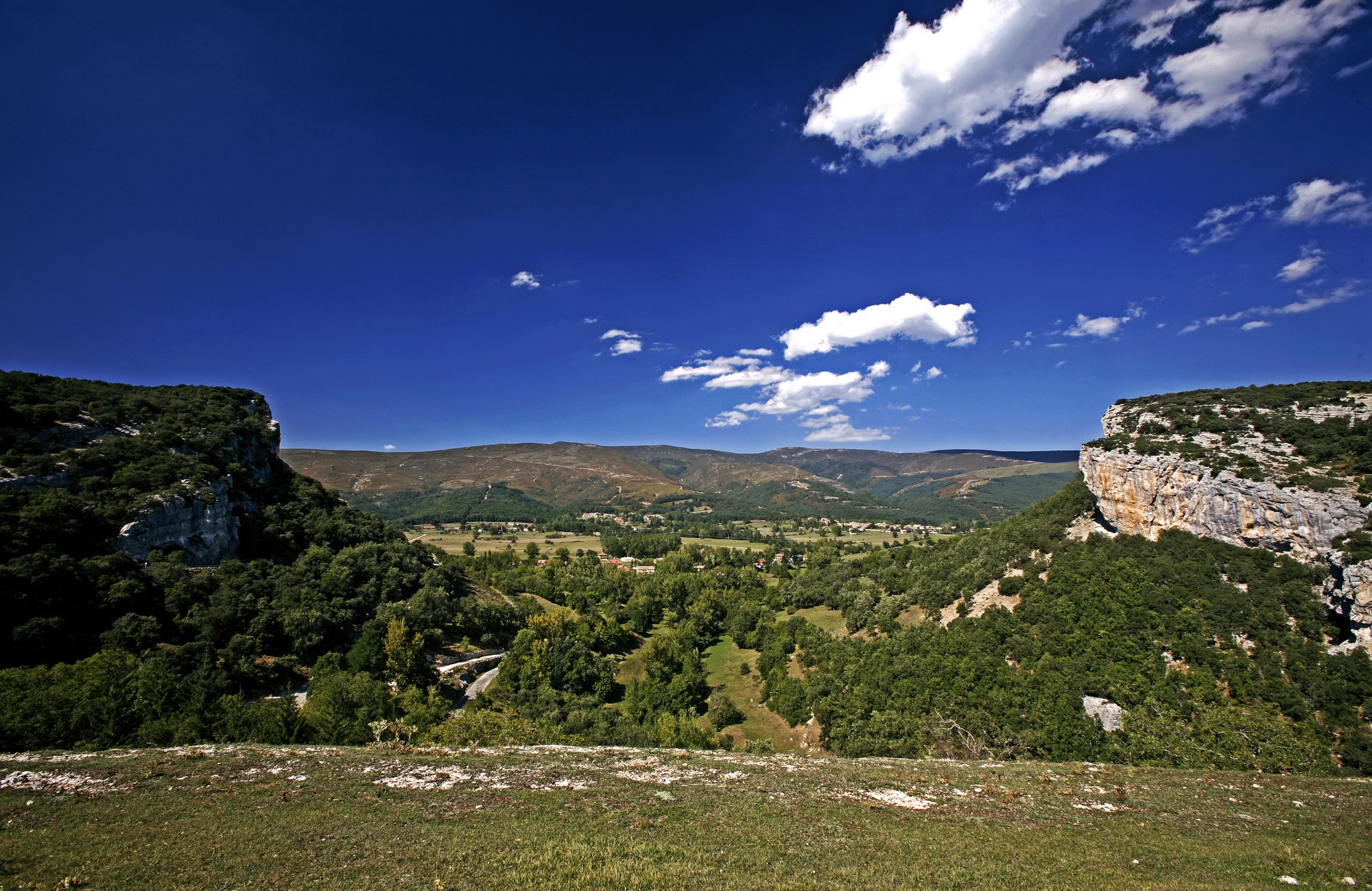
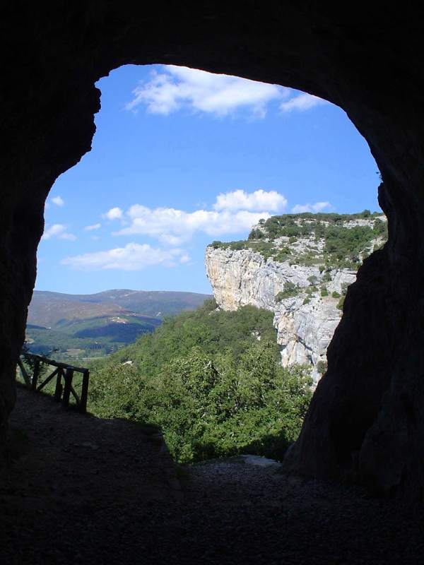
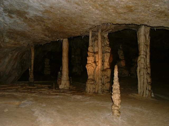
Located in the southern foothills of the Cantabrian Mountains, in the Burgos region of Las Merindades, this karst monument is formed by a set of cavities whose main network consists of one hundred and ten kilometers of topographical galleries, which makes it the second largest endokarst. development of the Iberian Peninsula and one of the largest in the world. Enter a unique refuge for bats and one hundred and ninety cave-dwelling species, many of them endemic, an important biodiversity reference, as well as archaeological as it has been inhabited since prehistoric times.
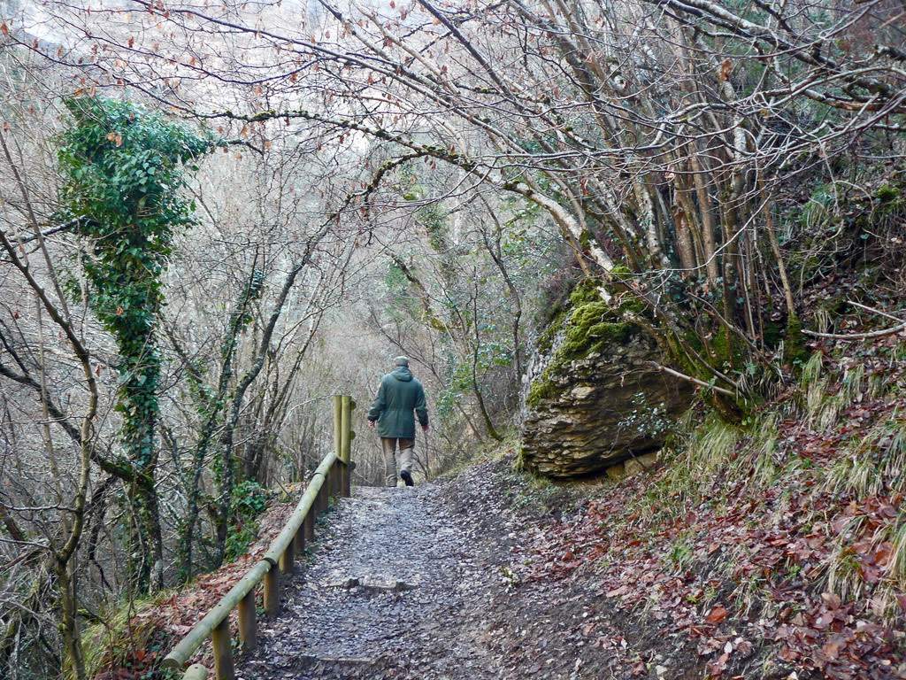
Explore lush forests of oaks, gall oaks and junipers that are home to birds of prey. Observe vultures, kites and Egyptian vultures in the rock formations, while in the undergrowth you find roe deer, foxes, genets and wild boars. In the shadier areas, the beech forests are home to the goshawk and marten, as well as the wild cat, and in the lower course of the river you can see otters.
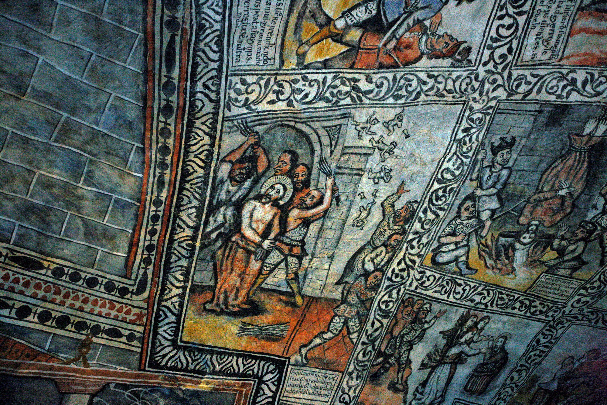
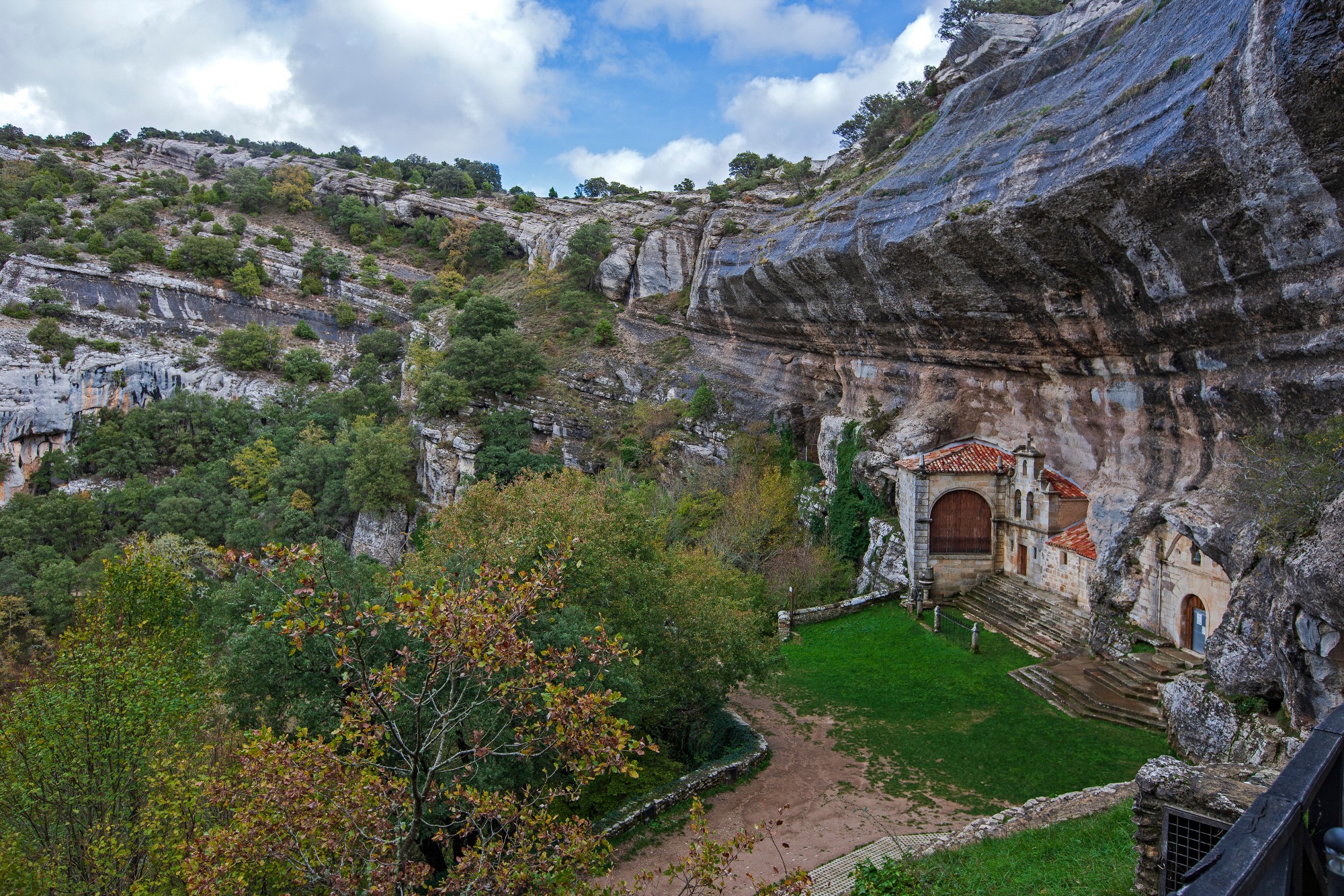
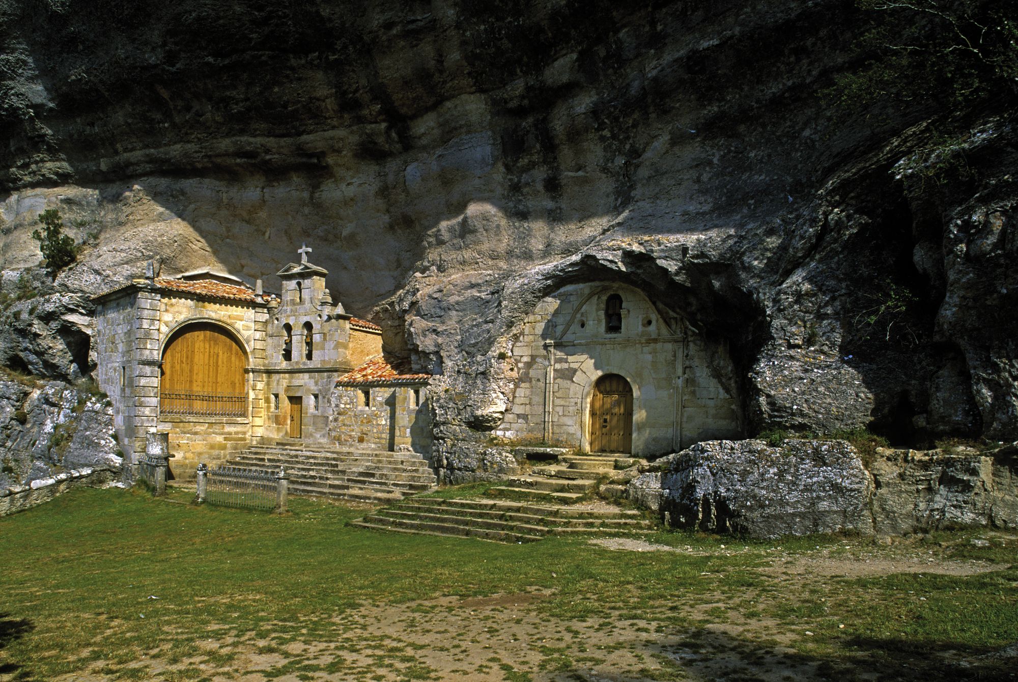
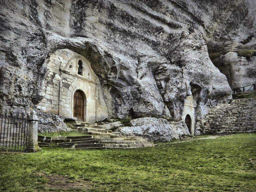
This natural treasure also has a rich history, from the Paleolithic to the Middle Ages, evidenced by cave paintings in the Palomera Cave and the Ermita de San Bernabé, a chapel built in the 18th century over a prehistoric cave that preserves wall paintings and a baroque altarpiece, through which you access one of the galleries that can be visited.
Explore the biodiversity and history of Ojo Guareña!
Prepare your visit
Image gallery
Enviromental Areas
- wildlife
- Numerous birds of prey, vultures, egyptian vultures, wild boar, fox and wildcat. 53 species of invertebrates cavemen have been detected inside.
- Relief
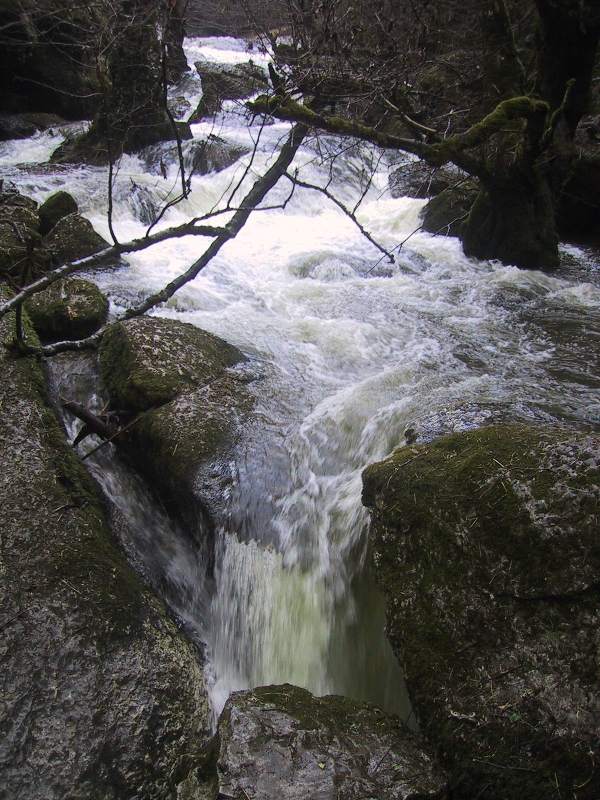
- Limestone cut on the southern slopes of the Cordillera Cantábrica. The Guareña River enters this massif originating the karstic complex of Ojo Guareña.
- Vegetation
- Oaks, Quercus pyrenaica (quejigo), forests of beech and pine forests. Algae, fungi and bacteria are located in caves.
Get to know this natural space
Park House 'Ojo Guareña'
At Casa del Parque you will find all the practical information you need to organize your visit to Ojo Guareña in the best possible way. Local and specialized monitors provide brochures, guides and personalized information.
In addition, visiting its rooms...
On map
Address
- Postal address Ctra. BU - 526 s/n. Quintanilla del Rebollar (Merindad de Sotoscueva). NaN. Burgos
- Web
- Phones947 138 838
Park House 'Ojo Guareña'
When to visit it?
Observations: Patrimonynatural.org/casas-del-parque/casas-del-parque/casa-del-parque-ojo-guarena
This portal is not responsible for possible changes in the schedules and rates reflected
Prepare your visit
Enjoy this natural space
On foot and by bike
- B3 B3 - Ventanón PathTo know more
Located in the Ojo Guareña Natural Monument. In the first section, the path runs along a slope covered by holm oaks, bringing us...
- Journey
- Circular
- Way
- On foot
- By bike
- Length
- 11 kms.
- Ascent slope
- 280 m.
- Difficulty of the route
- Medium
- B4 B4 - Path between GorgesTo know more
Located in the Ojo Guareña Natural Monument. Entre Desfiladeros is a surprising circular route, of little technical difficulty, that...
- Journey
- Circular
- Way
- On foot
- Length
- 12.38 kms.
- Ascent slope
- 239 m.
- Difficulty of the route
- Medium
- PRC-BU 40 Between gorgesTo know more
Rivers and streams from the nearby Cantabrian cordillera have made way between those two gorges to continue their course towards...
- Journey
- Circular
- Way
- On foot (2.5 h.)
- Length
- 11.8 kms.
- Ascent slope
- 200 m.
- Difficulty of the route
- Low
- PRC-BU 33 Channels DullaTo know more
The tour introduces us in a surprisingly way in a complex system of precipices known as the channels of the Duella, caused by the...
- Journey
- Circular
- Way
- On foot (4 h.)
- Length
- 15 kms.
- Ascent slope
- 800 m.
- Difficulty of the route
- Medium
- PRC-BU 32 El VentanonTo know more
The first section passes through a hillside covered with Holm oaks and brings us closer to the spectacular natural bridge known as...
- Journey
- Circular
- Way
- On foot (2.3 h.)
- By bike (2.3 h.)
- Length
- 10.9 kms.
- Ascent slope
- 280 m.
- Difficulty of the route
- Low
- PRC-BU 35 Horn PeakTo know more
This is a path of short duration that ascends through a Holm oak forest. From Cuerno peak we can admire an excellent panoramic of...
- Journey
- Linear
- Way
- On foot (0.2 h.)
- Length
- 0.6 kms.
- Ascent slope
- 130 m.
- Difficulty of the route
- Low
- Lagoons de AntuzanosTo know more
The origin of the lagoons ensemble is originated due to a localized and very deep subsidence of the land; this has meant that their...
- Journey
- Circular
- Way
- On foot (1.15 h.)
- By bike (0.3 h.)
- Length
- 4.8 kms.
- Recommended
- spring
- autumn
- winter
- Área recreativa vivero forestal de Quintanilla del rebollar Play areas of vivarium forest of Quintanilla del RebollarTo know more
The path is a nice walk under the shadow of different woods like chestnuts, oaks and Scots pine woods.
- Journey
- Circular
- Way
- On foot (0.3 h.)
- Length
- 1.9 kms.
- Difficulty of the route
- Low
- PRC-BU 34 Return to the PantarraTo know more
The route runs between Holm oaks and gall oaks from the Romanesque church of Butrera going along the high known as ‘Pantarra’.
- Journey
- Circular
- Way
- On foot (3 h.)
- By bike (3 h.)
- Length
- 8.7 kms.
- Ascent slope
- 560 m.
- PRC-BU 38 Roads SonsierraTo know more
This long route brings us close to the historical village of Espinosa de los Monteros. In the stretch of return from the surroundings...
- Journey
- Circular
- Way
- On foot (3.3 h.)
- By bike (3.3 h.)
- Length
- 16.5 kms.
- Ascent slope
- 250 m.
- Difficulty of the route
- Medium
- GR-1006 Route of the Monteros, from Espinosa de los Monteros to Medina de PomarTo know more
Meadows and pasturages cover with orchids during rainy springs. It is when most beautiful landscape displays. Hundreds of heads of...
- Journey
- Journey
- Way
- On foot (7 h.)
- Length
- 27 kms.
- Difficulty of the route
- Medium
- PRC-BU 37 The beech forest of QuintanillaTo know more
The route crosses several brooks and takes us into several forests where there are pines, ‘quercus’ (sessile oaks) and gall oaks.
- Journey
- Circular
- Way
- On foot (2.4 h.)
- By bike (2.4 h.)
- Length
- 10.9 kms.
- Ascent slope
- 700 m.
- Difficulty of the route
- High
- PRC-BU 31 ValleyTo know more
The road runs between oaks and Holm oaks, pasturages and villages that have retained their traditional architecture.
- Journey
- Circular
- Way
- On foot (2.15 h.)
- By bike (2.15 h.)
- Length
- 11.8 kms.
- Ascent slope
- 300 m.
- Difficulty of the route
- Low
- PRC-BU 36 Waterfall of MeaTo know more
The Mea brook collects water from the rain and the winter thaw; at certain times of the year it gives us a magnificent spectacle...
- Journey
- Linear
- Way
- On foot (0.1 h.)
- Length
- 0.3 kms.
- Ascent slope
- 100 m.
- Difficulty of the route
- Low
- PRC-BU 39 Way of NocedaTo know more
The tour goes between green fields to the Vallejas beech forest, located in the shadow of towering bluffs.
- Journey
- Circular
- Way
- On foot (2.3 h.)
- By bike (2.3 h.)
- Length
- 11.8 kms.
- Ascent slope
- 450 m.
- Difficulty of the route
- Low