
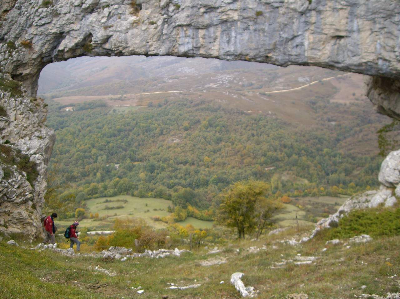
El Ventanon
- Route code
- PRC-BU 32
- Journey
- Circular
- Way
- On foot (2.3 h.)
- By bike (2.3 h.)
- Length
- 10.9 kms.
- Ascent slope
- 280 m.
- Difficulty of the route
- Low
- Web
- To know more
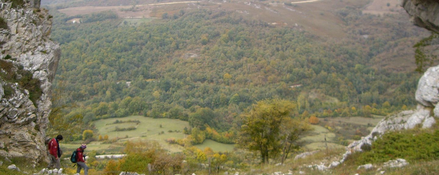
The first section passes through a hillside covered with Holm oaks and brings us closer to the spectacular natural bridge known as ‘The ventanon’.
Get to know the surroundings
Address and map location
- Postal address Villamartín de Sotoscueva (Merindad de Sotoscueva). NaN. Burgos