Mount Santiago Natural Monument
Image gallery
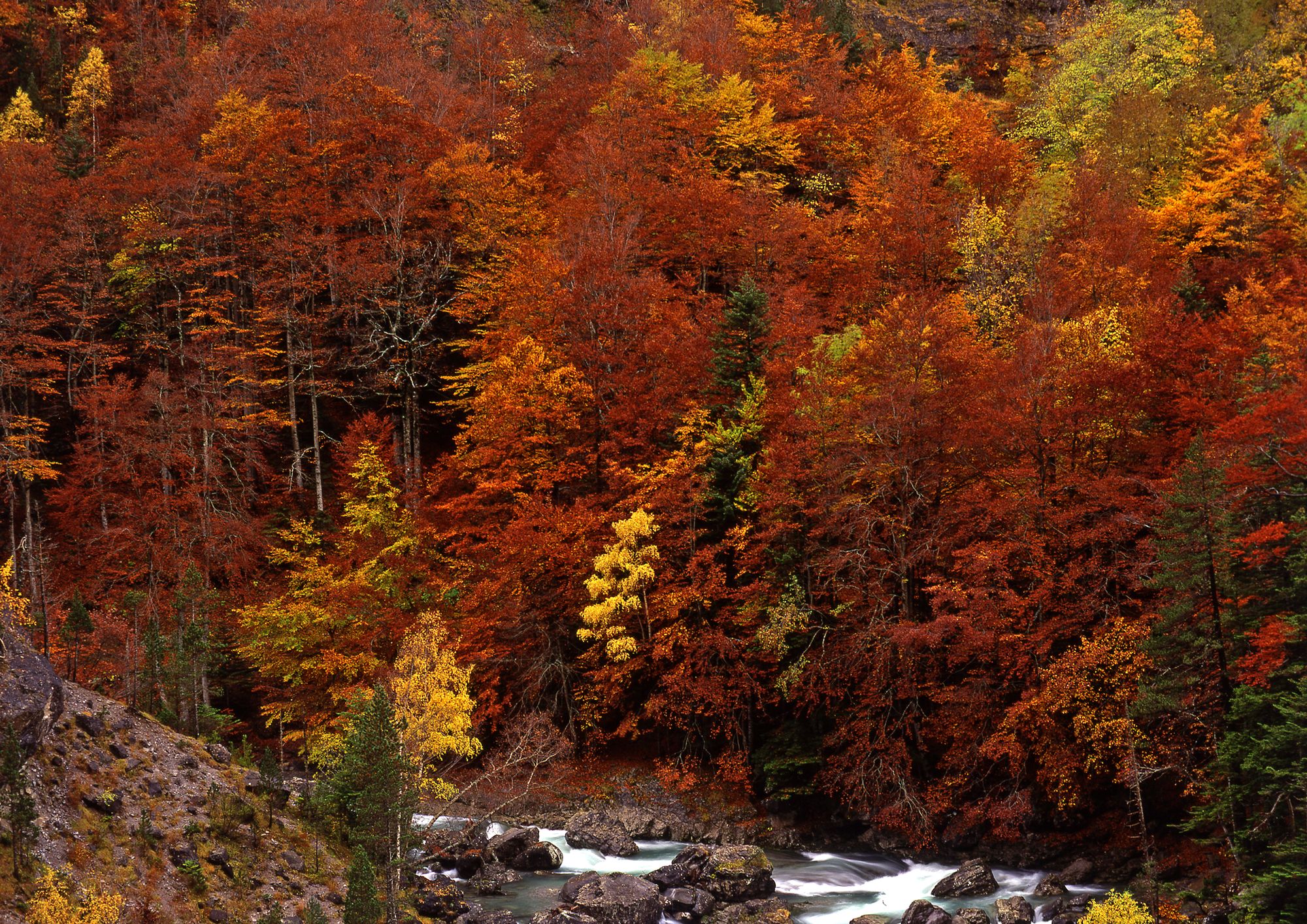

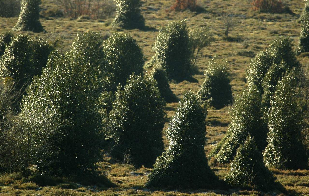
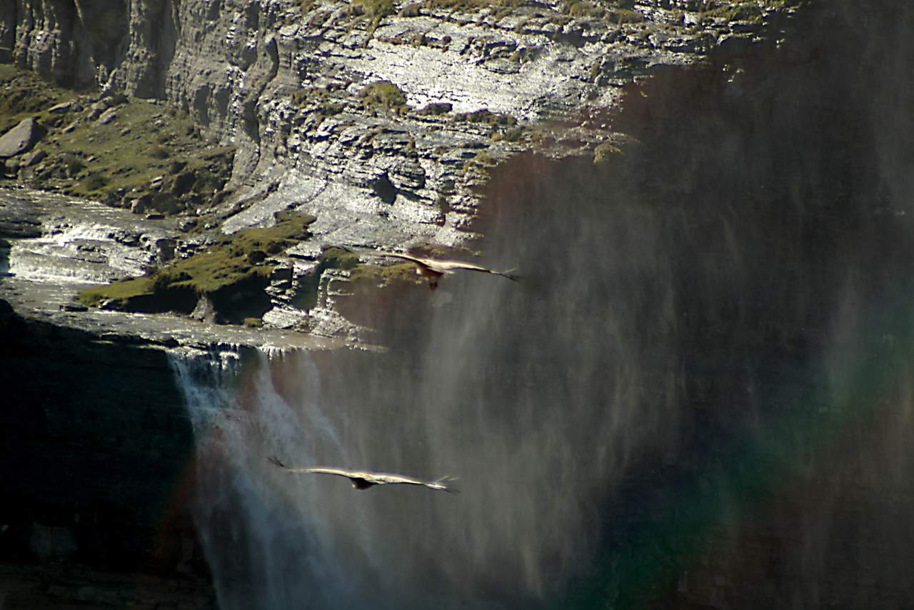
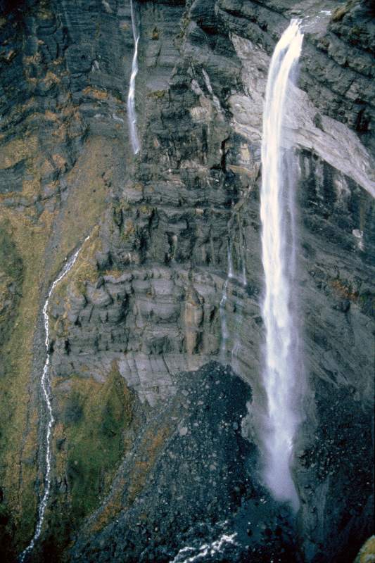
Don't miss the Mount Santiago Natural Monument, a unique place in the northeast of Burgos, between the Sierra Salvada and Sierra de Gibijo mountain ranges. Admire the lush beech forest that stretches to the edge of a rocky amphitheater formed by limestone ridges. See the Salto del Nervión, the highest waterfall in Spain, which falls from 222 meters high. Enjoy the contrast of colors between the water and the vegetation.
Explore the diversity of flora and fauna that inhabits the mountain. Spot griffon vultures, golden eagles, peregrine falcons and Egyptian vultures. Find the wolf, the roe deer, the wild boar, the squirrel, the otter and the wild cat. Follow the migratory bird corridor that crosses the territory.
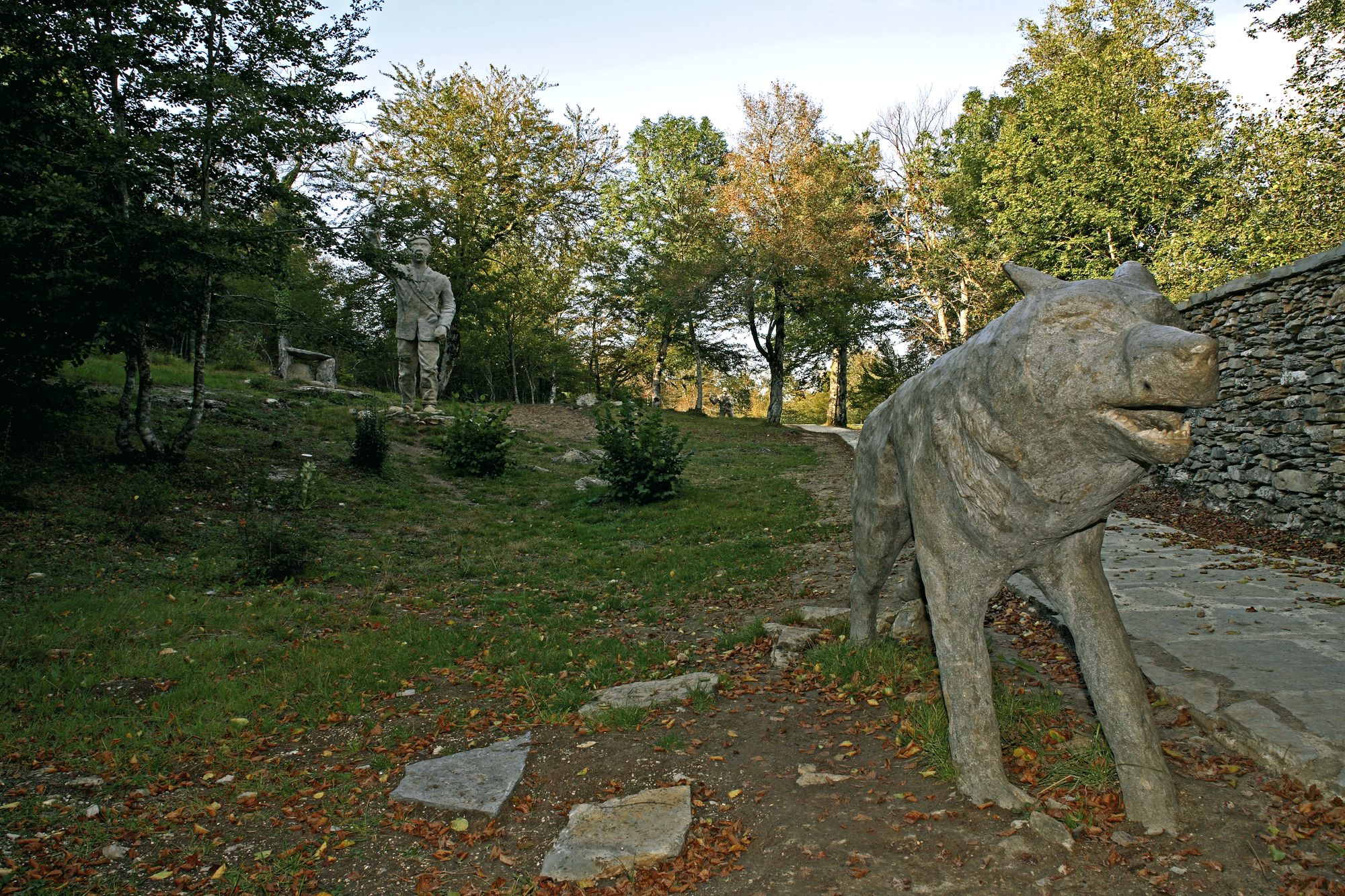
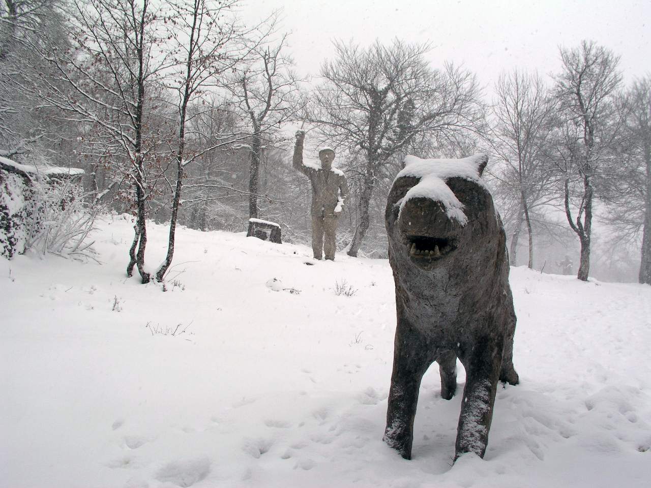
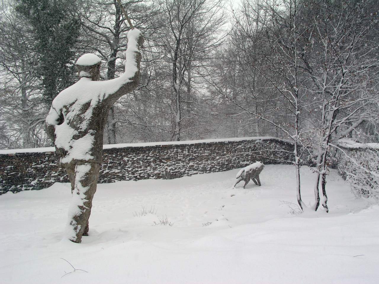
Discover the Wolf Lobera de Monte Santiago, the largest group of wolf hounds in Spain. Learn about the history and culture of wolf hunting in the 18th and 19th centuries. Immerse yourself in history and marvel at this Natural Monument!
Image gallery

Enviromental Areas
- wildlife
- Abundant copies of griffon vulture, golden eagle, short-toed eagle, peregrine falcon, egyptian vulture, wolf, roe deer, wild boar, squirrel, otter and wildcat. Area of migratory birds.
- Relief
- Impressive rocky amphitheatre formed by the limestone crests of Sierra Salvada and from that rush, a cascade of 300 meters, the river Nervión.
- Vegetation
- Predominant forest of beech trees. Also grows the Quercus pyrenaica (rebollo), holm oak, yew and hawthorn.
Get to know this natural space
Park House 'Monte Santiago'
A series of posters explain the evolution of this area from prehistoric times to the 20th century. Visitors can make their way through a 'beech wood' to a viewpoint offering superb views of the Fuente Santiago sinkhole.
On map
Address
- Postal address Ctra. BU-556 PK 341,6 a 3 Km. por la pista forestal. Berberana. NaN. Burgos
- Web
- Phones666 189 079
Prepare your visit
Enjoy this natural space
On foot and by bike
- Alternative PathwayTo know more
This is an alternative path to the trek that goes through a mixed forest of beech-pine wood and mountain pasturages.
- Journey
- Linear
- Way
- On foot (0.25 h.)
- Length
- 1.7 kms.
- Ascent slope
- 34 m.
- Recommended
- spring
- summer
- autumn
- winter
- Difficulty of the route
- Low
- B1 B1 - Path of the ViewpointsTo know more
Located in the Natural Monument of Mount Santiago. In Fuente Santiago, we take the track towards the Salto del Nervión viewpoint...
- Journey
- Circular
- Way
- On foot
- Length
- 6.28 kms.
- Ascent slope
- 163 m.
- Difficulty of the route
- Medium
- B2 B2 - Dehesa del Agua Path - Puerto de Orduña VariantTo know more
Located in the Natural Monument of Mount Santiago. On this circular route of about 17 kilometers and of moderate difficulty, we will...
- Journey
- Circular
- Way
- On foot
- By bike
- Length
- 17.42 kms.
- Ascent slope
- 369 m.
- Difficulty of the route
- Medium
- PR-BU 47 Charca de CortonTo know more
The trail goes through mountain pasturage where we will cross with mares and cows.
- Journey
- Linear
- Way
- On foot (0.3 h.)
- By bike (0.3 h.)
- Length
- 1.8 kms.
- Ascent slope
- 52 m.
- Difficulty of the route
- Low
- PR-BU 41+45+42 Circular Road LandscapeTo know more
We have excellent panoramic views from the viewpoints of 'Esquina Ruben' and 'Salto de Nervion' as well as from the path parallel...
- Journey
- Circular
- Way
- On foot (1.3 h.)
- Length
- 6.4 kms.
- Ascent slope
- 122 m.
- Recommended
- spring
- summer
- autumn
- winter
- Difficulty of the route
- Low
- PR-BU 49+47+46+41 Circular route Human UsesTo know more
Along these paths, you can see the different uses given to the mountain such as livestock and forest resources.
- Journey
- Circular
- Way
- On foot (2.3 h.)
- By bike (2.3 h.)
- Length
- 10.9 kms.
- Ascent slope
- 106 m.
- Recommended
- spring
- summer
- autumn
- winter
- Difficulty of the route
- Medium
- PR.BU.48+43+49 Hayedo Circular routeTo know more
A circular journey by the beech forest trail, especially recommended for the collection of mushrooms; in its tour by the PR-BU 49.
- Journey
- Circular
- Way
- On foot (1.45 h.)
- By bike (1.45 h.)
- Length
- 7.2 kms.
- Ascent slope
- 132 m.
- Recommended
- spring
- summer
- autumn
- winter
- Difficulty of the route
- Low
- PR-BU 44+45+41 Karst Circular routeTo know more
This is a journey through the beech forest of Monte Santiago in which we can admire different manifestations of the karstic complex,...
- Journey
- Circular
- Way
- On foot (1.3 h.)
- Length
- 6.4 kms.
- Ascent slope
- 122 m.
- Recommended
- spring
- summer
- autumn
- winter
- Difficulty of the route
- Low
- PR-BU 46 Orduña PortTo know more
The road runs parallel to the cliffs of a mountain pasturage area. We will see griffon vultures, short-toed snake eagles, Egyptian...
- Journey
- Linear
- Way
- On foot (0.35 h.)
- By bike (0.35 h.)
- Length
- 2 kms.
- Ascent slope
- 68 m.
- Difficulty of the route
- Low
- PR-BU 52 Pathway of PozalaguaTo know more
The route follows an old road that crosses a repopulation of Scots pine and mountain pasturages where we will find cattle in freedom.
- Journey
- Linear
- Way
- On foot (1.1 h.)
- By bike (1.1 h.)
- Length
- 4.2 kms.
- Ascent slope
- 64 m.
- Difficulty of the route
- Low
- PR-BU 45 Pathway of the CortadoTo know more
The route allows us to observe the typical relief at slope of Monte Santiago and Sierra Salvada. We can see several species of birds...
- Journey
- Linear
- Way
- On foot (0.45 h.)
- Length
- 2.7 kms.
- Ascent slope
- 122 m.
- Recommended
- spring
- summer
- autumn
- Difficulty of the route
- Medium
- PR-BU 49 Pathway of the DehesaTo know more
The route has remains of ancient uses of the forest such as coals, limestone quarries and pollarded beeches from which wood charcoal...
- Journey
- Linear
- Way
- On foot (0.2 h.)
- By bike (0.2 h.)
- Length
- 1.5 kms.
- Ascent slope
- 57 m.
- Difficulty of the route
- Low
- PR-BU 50 Pathway of the EncinarTo know more
The route begins in an Evergreen oak forest. At the top we will see mountain pasturages and the beginning of the forests of beeches.
- Journey
- Circular
- Way
- On foot (2.1 h.)
- By bike (2.1 h.)
- Length
- 8.3 kms.
- Ascent slope
- 300 m.
- Difficulty of the route
- Low
- PR-BU 43 Pathway of the HayedoTo know more
The trail runs partially along an old highway that goes by a beech forest, where if we are silent, we can see the typical fauna of...
- Journey
- Linear
- Way
- On foot (0.35 h.)
- By bike (0.35 h.)
- Length
- 1.7 kms.
- Ascent slope
- 26 m.
- Recommended
- spring
- autumn
- Difficulty of the route
- Low
- PR-BU 44 Pathway of the KarstTo know more
The trail passes by an old road under a beech forest. During the trek we can observe the karstic limestone model: sinkholes, limestone...
- Journey
- Linear
- Way
- On foot (0.35 h.)
- By bike (0.35 h.)
- Length
- 1.6 kms.
- Ascent slope
- 24 m.
- Difficulty of the route
- Low
- PRC-BU 99 ValpuestaTo know more
The trail climbs crossing forests of pines and Holm oaks that protect from the top the municipality and its spectacular Collegiate...
- Journey
- Circular
- Way
- On foot
- Length
- 9 kms.
- Ascent slope
- 400 m.
- Difficulty of the route
- Low
- PR-BU 41 Viewpoint Esquina de RubenTo know more
The trail runs along a forest track through a beech forest, with moderate slope which will give the viewpoint corner of Ruben, from...
- Journey
- Linear
- Way
- On foot (0.25 h.)
- By bike (0.25 h.)
- Length
- 1.7 kms.
- Ascent slope
- 98 m.
- Difficulty of the route
- Low
- PR-BU 42 Viewpoint of NervionTo know more
The trail goes along a forest track through a beech forest which ends on the viewpoint from which we will contemplate the spectacular...
- Journey
- Linear
- Way
- On foot (0.35 h.)
- By bike (0.35 h.)
- Length
- 2 kms.
- Ascent slope
- 17 m.
- Difficulty of the route
- Low
- PR-BU 51 Water DehesaTo know more
The route leads to the Virgin of the Txalazo, a monument of reinforced concrete that dates back to 1900, and the peak of el Fraile.
- Journey
- Circular
- Way
- On foot (3 h.)
- By bike (3 h.)
- Length
- 12.5 kms.
- Ascent slope
- 324 m.
- Difficulty of the route
- Medium
- PR-BU 48 Way of AlterlaTo know more
The route runs partly by an old road, in a mixed area with beech woods and mountain pasturages. We can see roe deer, foxes, badgers...
- Journey
- Linear
- Way
- On foot (1 h.)
- By bike (1 h.)
- Length
- 3.8 kms.
- Ascent slope
- 123 m.
- Recommended
- spring
- summer
- winter
- Difficulty of the route
- Medium-Low