
Archeological site of Castro del Pedroso
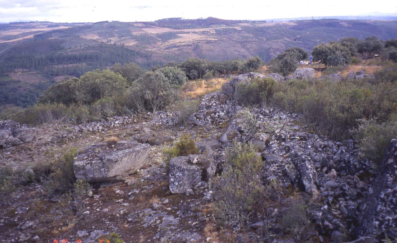
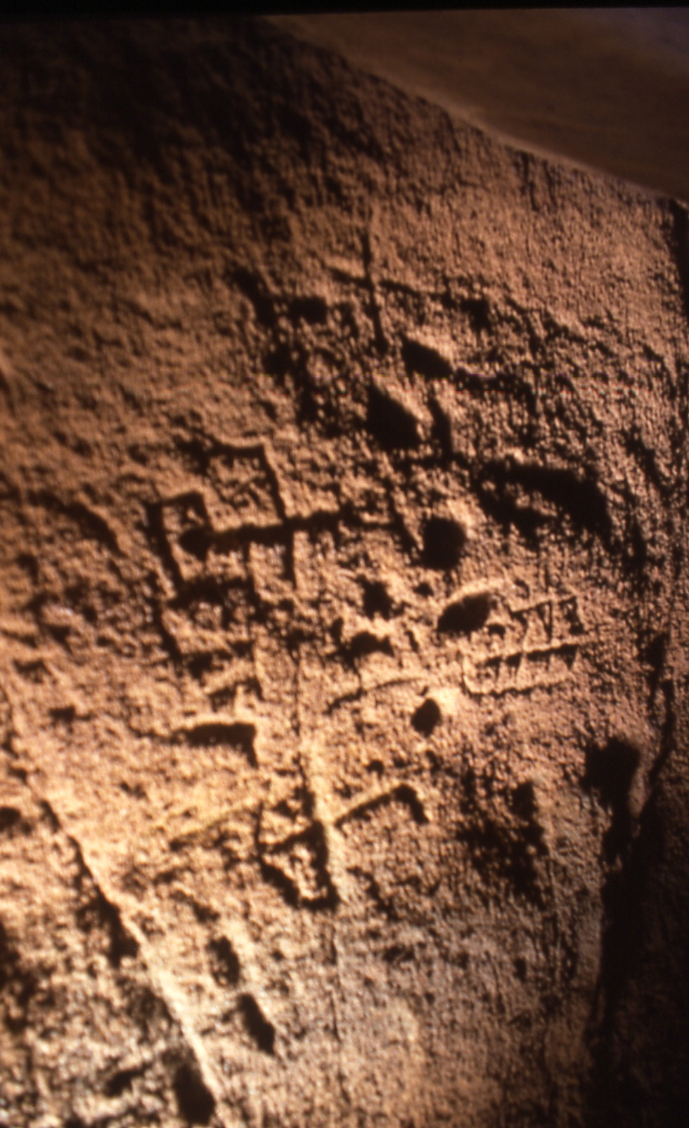
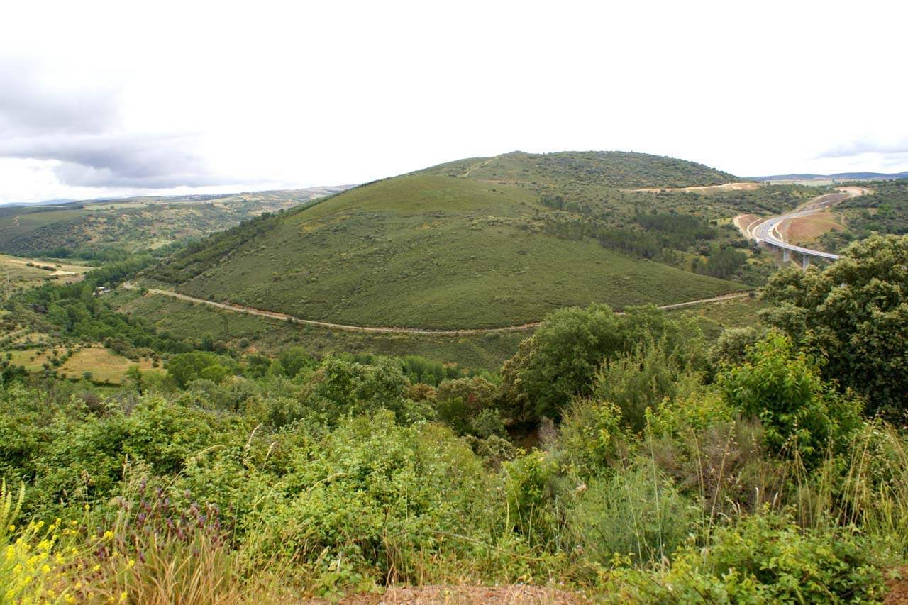
The fort is located on a hill with an irregular plan bounded by an irregularly shaped 3-hectare walled enclosure, and reinforced in some places by flagstones. You can also identify a circular structure attached to the inside of the wall. In the western part, the area for housing could be located, since it is in this area where the greatest number of ceramic remains of the entire castro has been found. Due to these ceramic findings, it could be dated between the Neolithic and the Initial Bronze, and can even go as far as the Iron Age. They also determined that there is a clear relationship between Castro del Pedroso and neighboring Portuguese forts. There are schematic engravings on the granite but very deteriorated.
Image gallery
Historical Data
- Architecture
- Archaeology site
- Construction
- Neolithic fortified settlement
- Historical Period
- Neolithic
- Bronze Age
Get to know the surroundings
Address and map location
- Postal address En la margen derecha del río Manzanas. San Martín del Pedroso (Trabazos). NaN. Zamora
Tourist information
Trabazos town hall
To know moreAddress and map location
- Postal address Concejo, 1. municipality of Trabazos . 49516. Zamora
- Web
- Phones980 681 085
- Fax980 681 085
Zamora tourism office
Address and map location
- Postal address Avda. Principe de Asturias, 1. Zamora. NaN. Zamora
- Web
- Phones980 531 845
To know more