
Picos de europa mountains
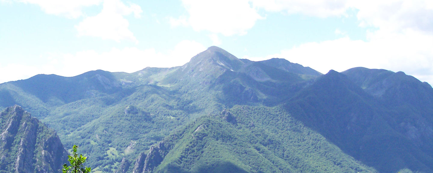
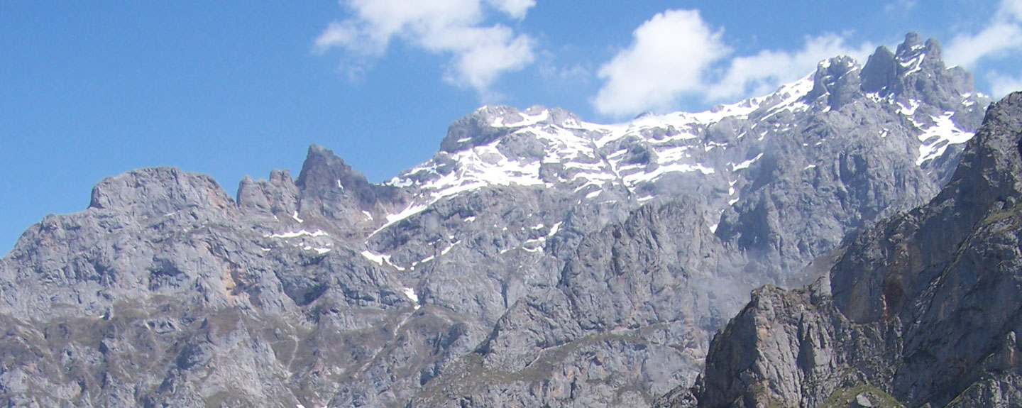
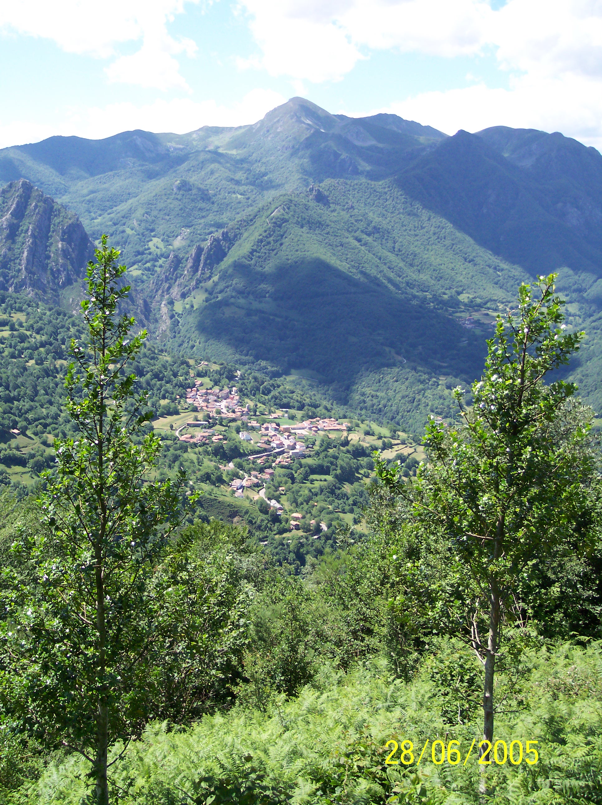
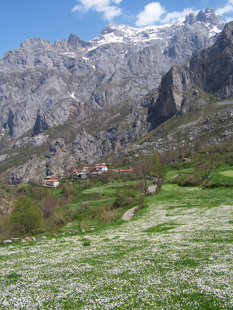
These mountains are situated in the Cantabrian Range; together with the National Park of the same name, they form a spectacular mountain landscape rising up between the provinces of Asturias, Cantabria and León.
They are known to have been inhabited by Man since the Upper Palaeolithic Age (between 35,000 and 10,000 years ago). Traces of these primitive inhabitants, who were essentially hunters, can be seen in a large number of caves, the site of the remains of bones, utensils and magnificent cave paintings, which have recently been included on the World Heritage List.
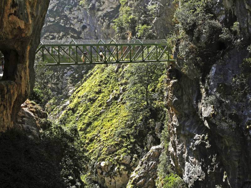
The breathtakingly beautiful mountain scenery and the exceptional network of hiking trails attract visitors from all over the world. The most stunning of these trails is possibly the Cares Route that runs parallel to the spectacular River Cares, following a ravine whose side walls are separated on some stretches by mere tens of metres, nestling at the foot of the impressive waterfalls that drop down almost vertically for more than 1,500 metres from the peaks of this mountain range.
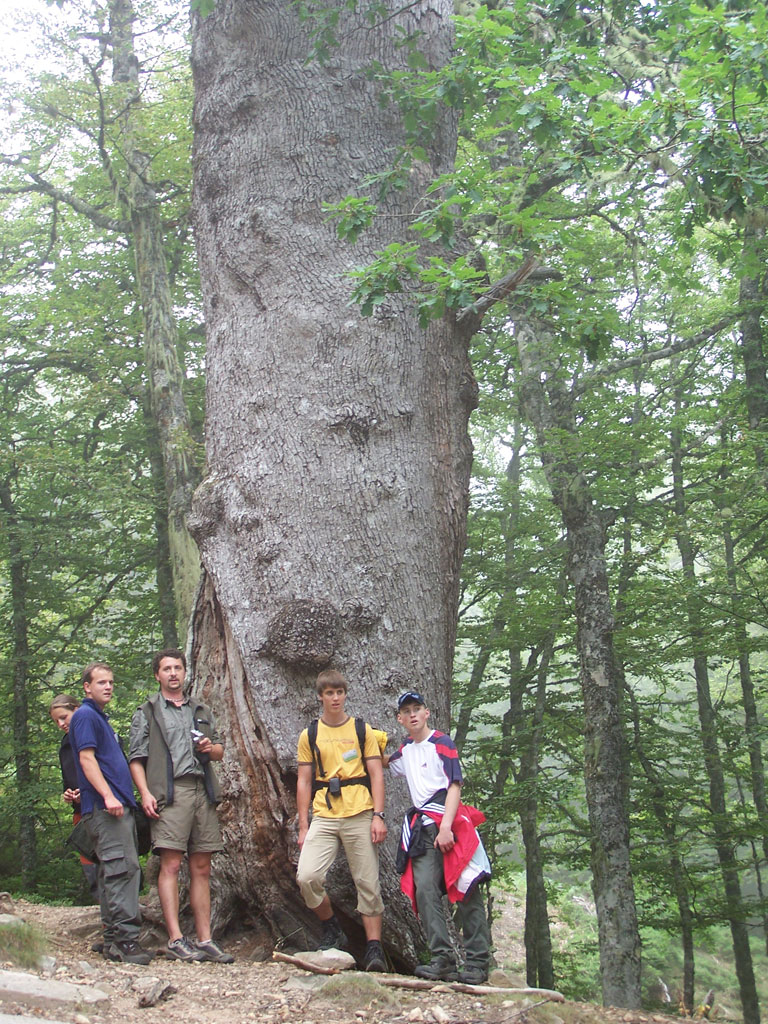
Image gallery
Enjoy this natural space
On foot and by bike
- PR-PNPE 3 Cares RouteTo know more
The best-known trail of the Picos de Europa passes through the towns of: Posada de Valdeón, Cordiñanes, Caín and Poncebos. Interesting...
- Journey
- Linear
- Way
- On foot (5 h.)
- Length
- 21 kms.
- Ascent slope
- 160 m.
- Descent slope
- 899 m.
- Difficulty of the route
- Medium
- PR-PNPE 16 Collado JermosoTo know more
The shelter Collado Jermoso is located on a natural terrace on the western edge of Macizo Central. It has the best views of the valley...
- Journey
- Linear
- Way
- On foot (4 h.)
- Length
- 4.1 kms.
- Ascent slope
- 1,214 m.
- Difficulty of the route
- High
- L7 L7 - Arquitectura popular SajambreTo know more
Ubicado en el Parque Nacional Picos de Europa. El recorrido pone en valor la arquitectura tradicional de la zona, entre los que el...
- Journey
- Circular
- Way
- A pie
- Length
- 8,5 kms.
- Ascent slope
- 600 m.
- Difficulty of the route
- Medium
- L8 L8 - Arquitectura popular ValdeónTo know more
Ubicado en el Parque Nacional Picos de Europa. La ruta se inicia en Posada de Valdeón y continúa por Soto y Caldevilla, donde, además...
- Journey
- Linear
- Way
- A pie
- Length
- 8,2 kms.
- Ascent slope
- 324 m.
- Difficulty of the route
- Low
- PR-PNPE 14 Monto Route (Valle de Prada)To know more
The route begins in Prada and gains altitude among agricultural meadows surrounded by trees and shrubs, home of several animal species.
- Journey
- Linear
- Way
- On foot (4.45 h.)
- Length
- 11.6 kms.
- Ascent slope
- 610 m.
- Difficulty of the route
- Medium
- GR-PNPE 201 Pathway of the Arcediano. Long Pathway Ponton-AmievaTo know more
This route was once one of the most important communication routes between Eastern Asturias and the plateau of Castilla y Leon, the...
- Journey
- Linear
- Way
- On foot (9.1 h.)
- Length
- 27.5 kms.
- Ascent slope
- 776 m.
- Descent slope
- 1,470 m.
- Difficulty of the route
- Medium
- GR-PNPE 201 Pathway of the Arcediano. Short Pathway Ponton-Soto de SajambreTo know more
It is one of the most important communication routes between the Plateau and the Eastern Asturias. The shortest path connects the...
- Journey
- Linear
- Way
- On foot (3.55 h.)
- Length
- 11 kms.
- Ascent slope
- 211 m.
- Descent slope
- 575 m.
- Difficulty of the route
- Medium
- PR-PNPE 15 Pathway of the little market. Long route. Posada de Valdeon-Fuente DeTo know more
It is so called because the inhabitants used the path to attend fairs and markets of livestock in the neighbouring region. The route...
- Journey
- Linear
- Way
- On foot (4.3 h.)
- Length
- 13.2 kms.
- Ascent slope
- 831 m.
- Descent slope
- 692 m.
- Difficulty of the route
- Medium
- PR-PNPE 15 Pathway of the little market. Short route. Santa Marina de Valdeon-Fuente DeTo know more
It is a variant of the journey, and allows reaching Fuente De in shorter time. The path was named for its role as route to the neighbouring...
- Journey
- Linear
- Way
- On foot (3.45 h.)
- Difficulty of the route
- Medium
- PR-PNPE 11 Route from Puerto de Panderrueda to Posada de ValdeonTo know more
This is a rich path in fauna and flora. Accompanied by beech woods we will cross many rivers and streams, as the Cares in its high...
- Journey
- Linear
- Way
- On foot (4 h.)
- Length
- 13.5 kms.
- Descent slope
- 511 m.
- Difficulty of the route
- Low
- PR-PNPE 10 Route villages of SajambreTo know more
The route shows the balance between traditional activities and respect for the environment, so, in this path we will discover the...
- Journey
- Circular
- Way
- On foot (3.3 h.)
- Length
- 10.2 kms.
- Ascent slope
- 405 m.
- Descent slope
- 405 m.
- Difficulty of the route
- Low
- PR-PNPE 15 Senda del MercadilloTo know more
Esta ruta discurre por lo que se conocía como las sendas del mercadillo, caminos utilizados por los vecinos de Valdeón para acudir...
- Journey
- Linear
- Way
- A pie (9 h.)
- Length
- 26,4 kms.
- Ascent slope
- 831 m.
- Descent slope
- 692 m.
- Difficulty of the route
- Medium
- GR-PNPE 9 Soto-Vegabaño RouteTo know more
The journey begins in Soto de Sajambre, town of traditional architecture, and approaches Vegabaño through a path that is known as...
- Journey
- Circular
- Way
- On foot (3.15 h.)
- Length
- 9.8 kms.
- Ascent slope
- 391 m.
- Difficulty of the route
- Low
- PR-PNPE 12 Vega de Llos RouteTo know more
The valley of Valdeon is one of the best preserved of the National Park. The route begins in Posada and approaches the peaks of the...
- Journey
- Circular
- Way
- On foot (4 h.)
- Length
- 13.5 kms.
- Descent slope
- 511 m.
- Difficulty of the route
- Low
Active Tourism activity search engine
Natural Espace
 Picos de Europa