
Aliste River BTT Route
- Route code
- CCL-ALI-006
- Journey
- Linear
- Way
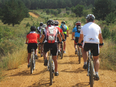
- By bike (6 h.)
- Length
- 68.8 kms.
- Ascent slope
- 788 m.
- Difficulty of the route
- Medium
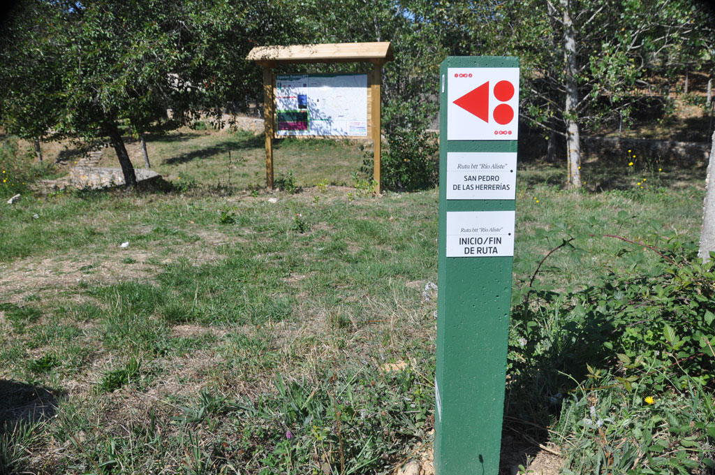
- Route
- From San Pedro de las Herrerías to Carbajales de Alba
- Web
- To know more
In the direction of its course, it begins at the source of San Pedro de las Herrerías, in the heart of the Sierra de la Culebra , from approximately 1,110 meters, it travels descending through the towns that form the valley that makes up the region of its same name, crossing also Tierra de Alba, where it acquires the appearance of a reservoir due to the influence of the Ricobayo dam, and runs through the towns of Mahíde, Las Torres de Aliste, Pobladura de Aliste, Palazuelo de las Cuevas, San Vicente de la Cabeza, Bercianos de Aliste, Flores from Aliste, Gallegos del Río, Domez, Vegalatrave, Vide de Alba, El Castillo de Alba, and ends in Carbajales de Alba.
The Aliste River , approximately 72 kilometers long, has a very variable flow during its course, reaching low levels in some summers of dry years, especially in the upper channel. In winter it carries a lot of water with contributions from its Mena and Frío tributaries, along with other small streams that flow from the Sierra de la Culebra.
The route in its upper course is frequented on its banks by alder trees (which give the river its name), poplars and ash trees, and dotted with traditional flour mills , dovecotes , water wheels , and stone pontoons.
Starting from the town of Vide de Alba, the Aliste River makes its way, widening its channel, and the characteristic riverside forest disappears, with its entrance towards the Ricobayo reservoir.
Of interest, Alba El Castillo , in the town of the same name, is a 12th century fortress, which still preserves part of its walls and one of the towers, stands on a hill above the river, and was inhabited by Knights Templar. and reformed under the mandate of its resident Álvaro de Luna, and already in the 15th century, it experienced its greatest glories with the county of Alba and Aliste with Enrique IV.
In Carbajales de Alba, at the end of the route, is El Fuerte de "San Carlos" , a bastioned fortification built between the 16th century. XVII, related to the defensive fortresses of the Spanish-Portuguese border. Its construction began at the beginning of the 20th century. XVII, reformed or finished in 1702. The fort also played an important role in the War of Independence. Currently only ruins remain, and thanks to recent consolidation works, part of the fort has been recovered.
Image gallery


Get to know the surroundings
Address and map location
- Postal address San Pedro de las Herrerias (Mahide). Zamora
- Web