Hoces del Río Duraton Natural Park
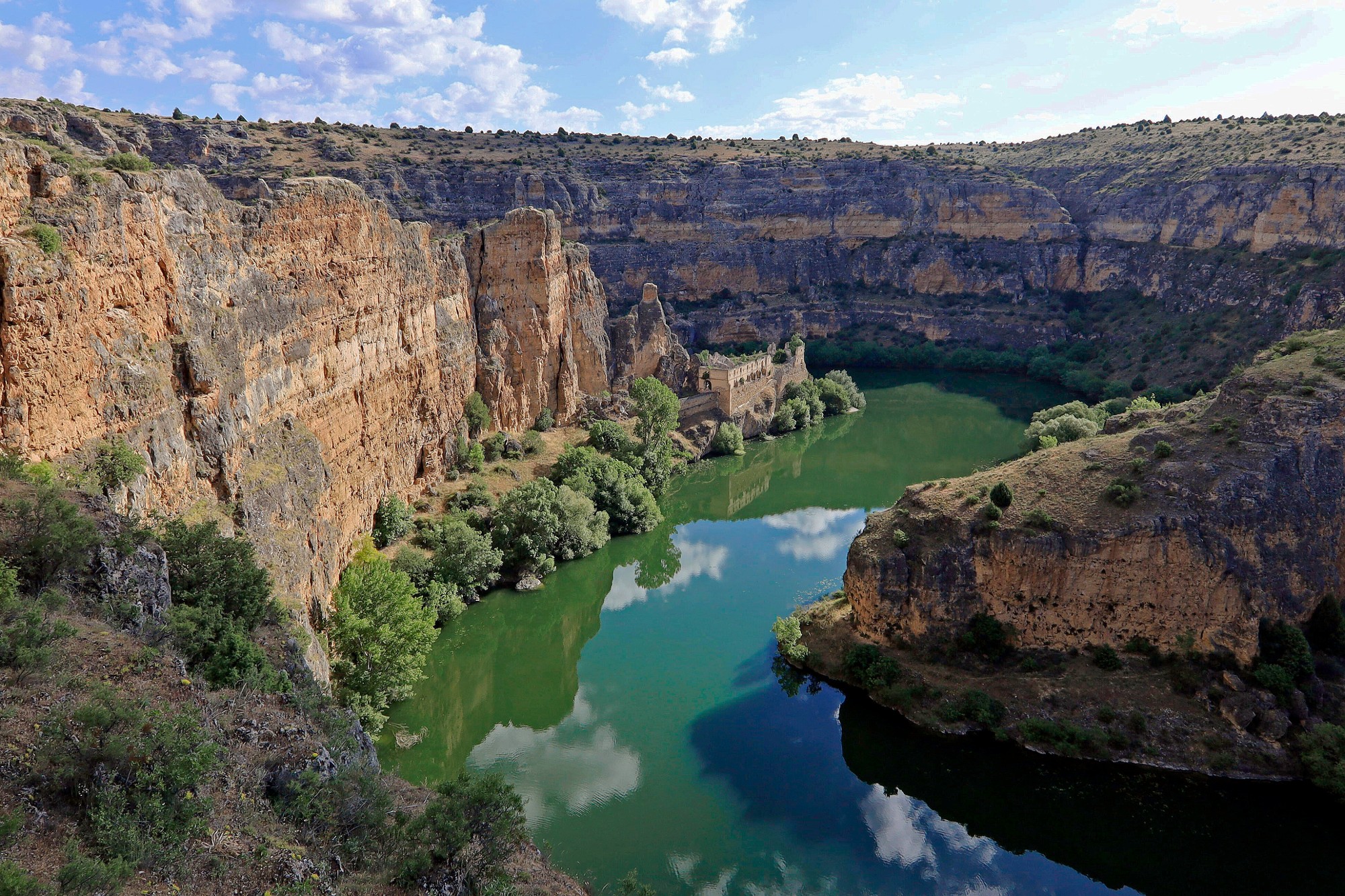
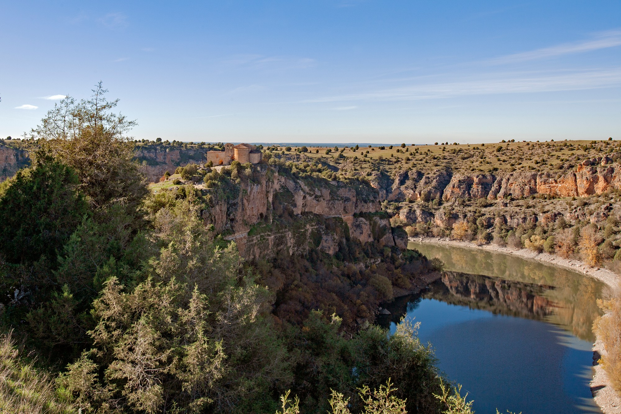
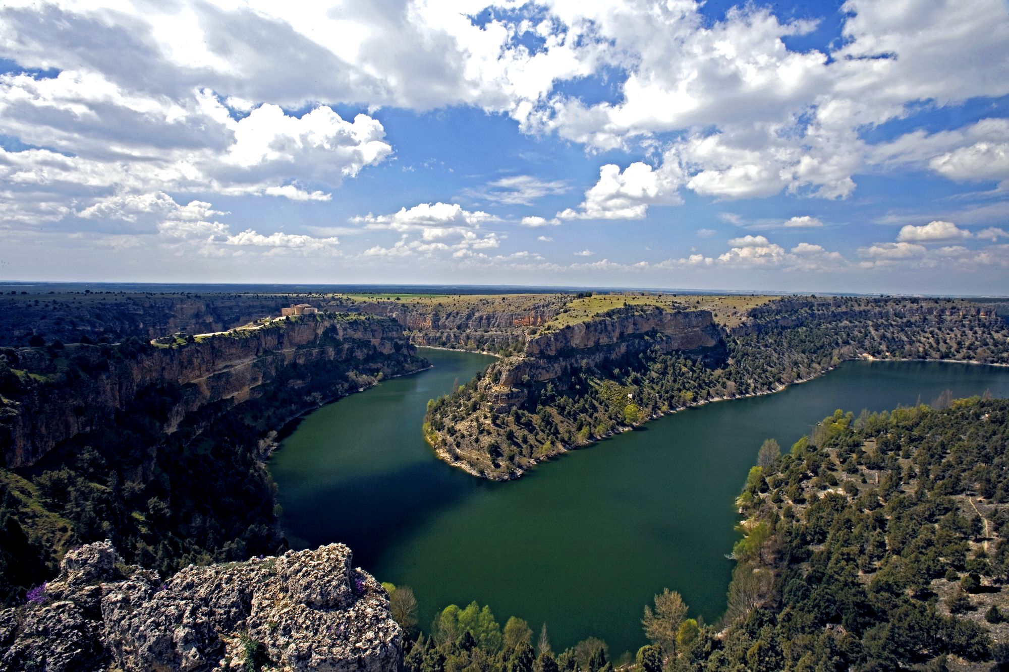
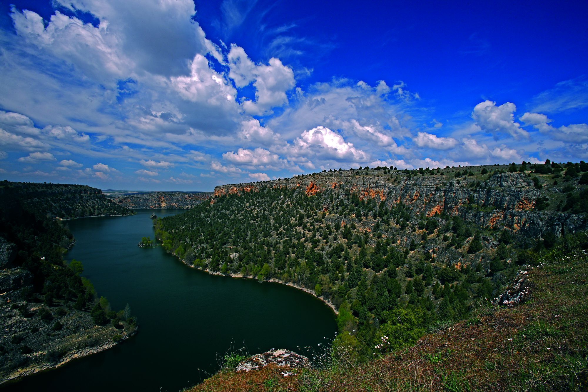
Explore the Hoces del Río Duraton Natural Park, a dream corner between Sepúlveda and the Burgomillodo reservoir. The Duratón River has sculpted a majestic canyon with walls more than 100 meters high and rocks dyed a captivating ocher, creating a contrast with the lush riverside vegetation.
Discover the high walls where birds of prey such as the griffon vulture, Egyptian vulture, golden eagle and peregrine falcon nest. The park is divided into four areas with diverse vegetation, from sessile juniper forests and resin pine forests to unique rock communities and riverside forests.
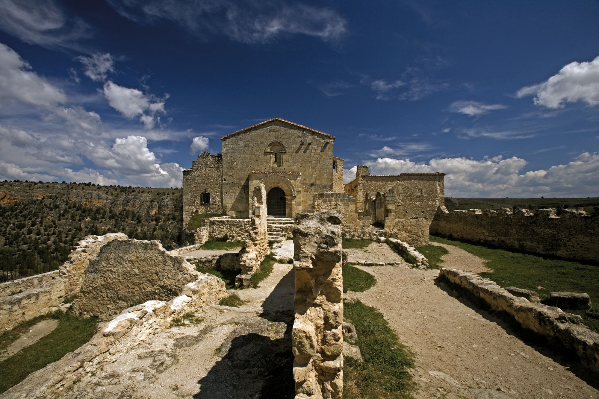
Explore the Hoz del Duratón, where the river and its tributaries have given life to natural beauty intertwined with a rich archaeological and historical heritage, such as the Benedictine Priory of San Frutos and the convent of Nuestra Señora de la Hoz. Discover the caves with engravings from the Bronze Age and the architectural complex of Sepúlveda, famous for its delicious gastronomy.
Prepare your visit
Image gallery
Enviromental Areas
- wildlife
- A paradise for birds of prey, with Griffon vultures and Egyptian vultures. They coexist with peregrine falcons, buzzards and kestrels.
- Relief
- Extensive collection of gorges, canyons and cliffs excavated by the river Duratón out of Mesozoic limestone.
- Vegetation
- An area dominated by the incense juniper, rock clefts and slopes with rock-dwelling species and riverbank woods alongside the river.
Get to know this natural space
Park House 'Hoces del Río Duratón'
The reception area is located in the Visitor Centre. There is also a notice board with details of activities in the Centre, other initiatives and events in the region and information of interest for both visitors and local residents.
On map
Address
- Postal address C/ Conde de Sepúlveda, 34. Sepúlveda. NaN. Segovia
- Web
- Phones921 540 322
Prepare your visit
Enjoy this natural space
On foot and by bike
- Ermita de San Frutos Hermitage of San FrutosTo know more
This route is one of the most attractive places of the Park due to its breathtaking views.
- Journey
- Linear
- Way
- On foot (0.15 h.)
- By bike (0.15 h.)
- Length
- 1 kms.
- Ascent slope
- 70 m.
- Recommended
- spring
- autumn
- Difficulty of the route
- Low
- Senda Larga Pathway from Talcano bridge to Villaseca bridgeTo know more
The main attraction of the path is the landscape and flora and fauna richness. You have to be careful because it is a natural reserve.
- Journey
- Linear
- Way
- On foot (3 h.)
- By bike (3 h.)
- Length
- 12 kms.
- Ascent slope
- 40 m.
- Difficulty of the route
- Medium-Low
- Senda de la Glorieta Pathway of the GlorietaTo know more
The route offers a large, spectacular panoramic of the valley covered by the River Caslilla.
- Journey
- Linear
- Way
- On foot (0.3 h.)
- By bike (0.3 h.)
- Length
- 0.9 kms.
- Recommended
- spring
- autumn
- Difficulty of the route
- Low
- Senda de la Molinilla Pathway of the MolinillaTo know more
The path is very simple and educative, what allows observing the main features of the canyon. It should be noted the presence of...
- Journey
- Linear
- Way
- On foot (0.2 h.)
- By bike (0.2 h.)
- Length
- 1.8 kms.
- Ascent slope
- 14 m.
- Recommended
- spring
- autumn
- Difficulty of the route
- Low
- PR-SG 11 Pathway of the VegaTo know more
The use of hiking boots is essential for this trek.
- Journey
- Linear
- Way
- On foot (2 h.)
- By bike (2 h.)
- Length
- 4.5 kms.
- Ascent slope
- 5 m.
- Recommended
- spring
- autumn
- Difficulty of the route
- Low
- Senda dos ríos Pathway of the two riversTo know more
The path offers a spectacular landscape of the canyon, as well as numerous items of historical and artistic heritage of Sepulveda.
- Journey
- Circular
- Way
- On foot (1.3 h.)
- Length
- 5 kms.
- Ascent slope
- 80 m.
- Recommended
- spring
- autumn
- Difficulty of the route
- Medium
- SE6 SE6 - Path of the Two RiversTo know more
Located in the Hoces del Río Duraton Natural Park. Above the first sickle that describes the Duratón River rises the medieval town...
- Journey
- Circular
- Way
- On foot
- Length
- 5.6 kms.
- Ascent slope
- 270 m.
- Difficulty of the route
- Medium
Active Tourism activity search engine
Get to know the surroundings
Address and map location
It's happening
- only 31 October
- Dates
- October 31, 2026