
Castile Canal
- Position
- Burgos province
- Palencia province
- Valladolid province
- Type of route
- Large tour
- Web
- To know more
This impressive piece of hydraulic engineering was built in the 18th and 19th century to get rid of surplus grain.
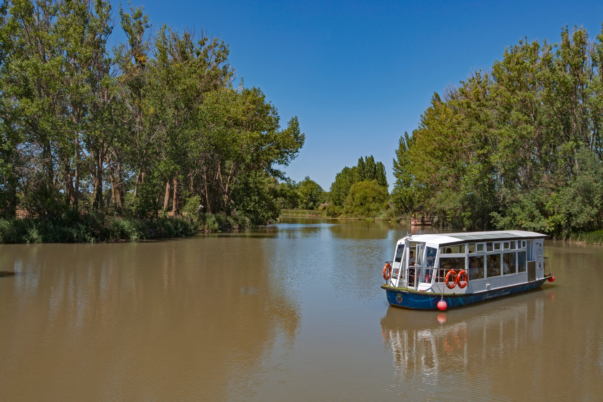
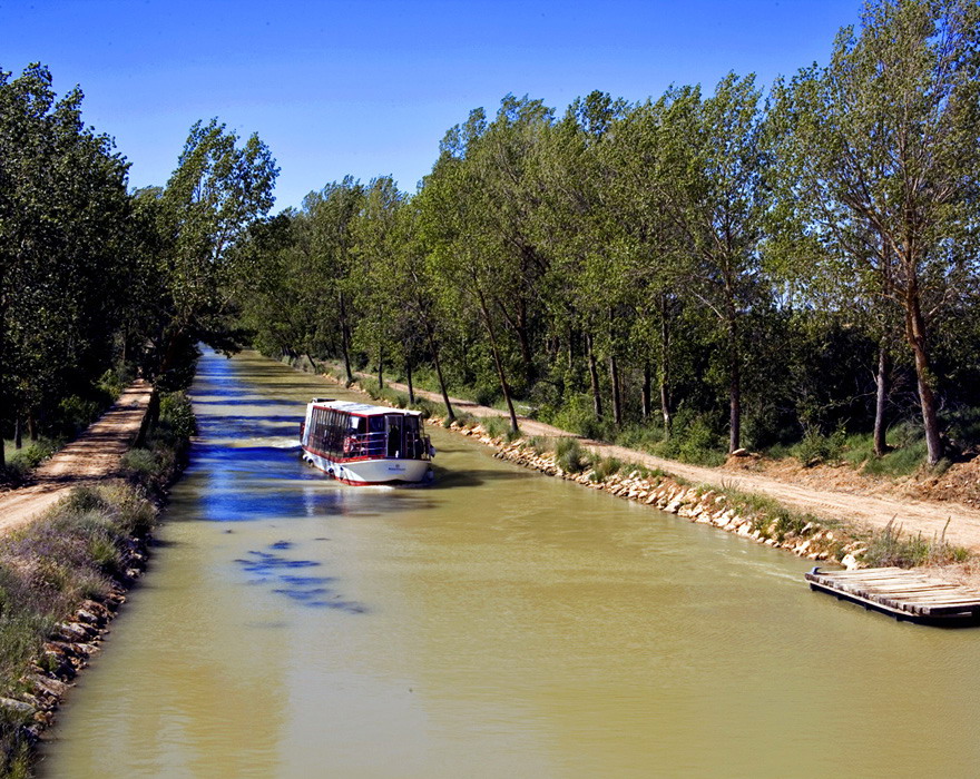
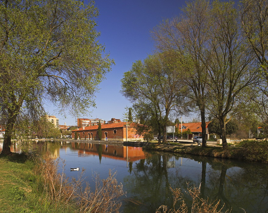
Initially designed as a means of transporting goods, the canal eventually closed to traffic in the mid 20th century. Today an Asset of Cultural Interest, since 1959 its principal function has been that of irrigation, although it is also one of Castilla y León’s most popular tourist routes, admired for its stunning natural landscapes, and the wealth of artistic and historic heritage to be found in the cities that stand on its banks.
150 years later, this artificial river which flows 205km along the Meseta between the province of Palencia and Valladolid, has become an interesting cultural trail, offering the architectural diversity of its three branch roads which take tourists along the Ramal del Norte, the Ramal del Sur and the Ramal de Campos. The route combines the natural environment found along the riverbanks with the history and tradition of the towns.

Prepare your visit
Image gallery
Find out

Data of interest
Engineering and architecture of the Canal
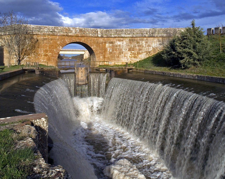
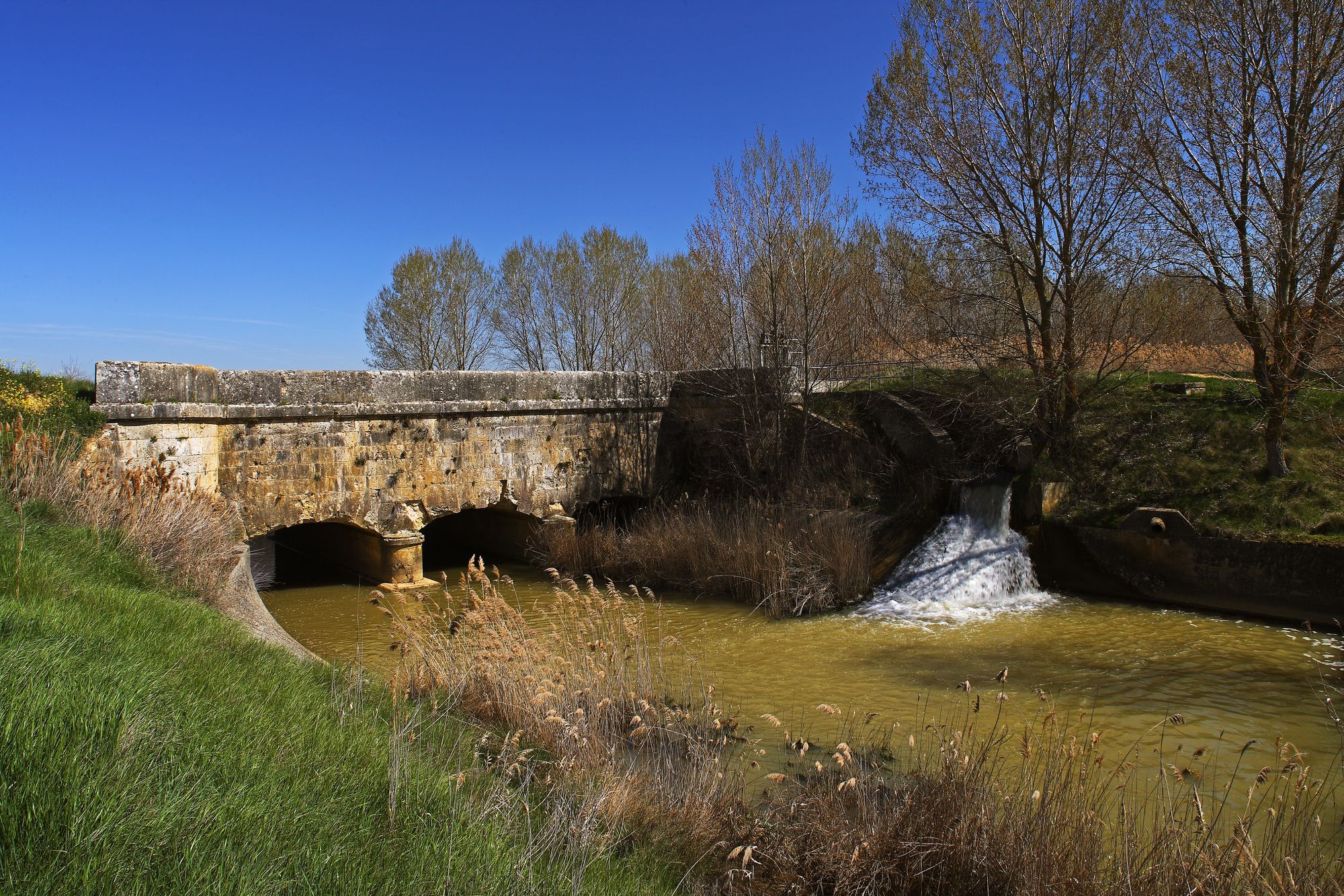
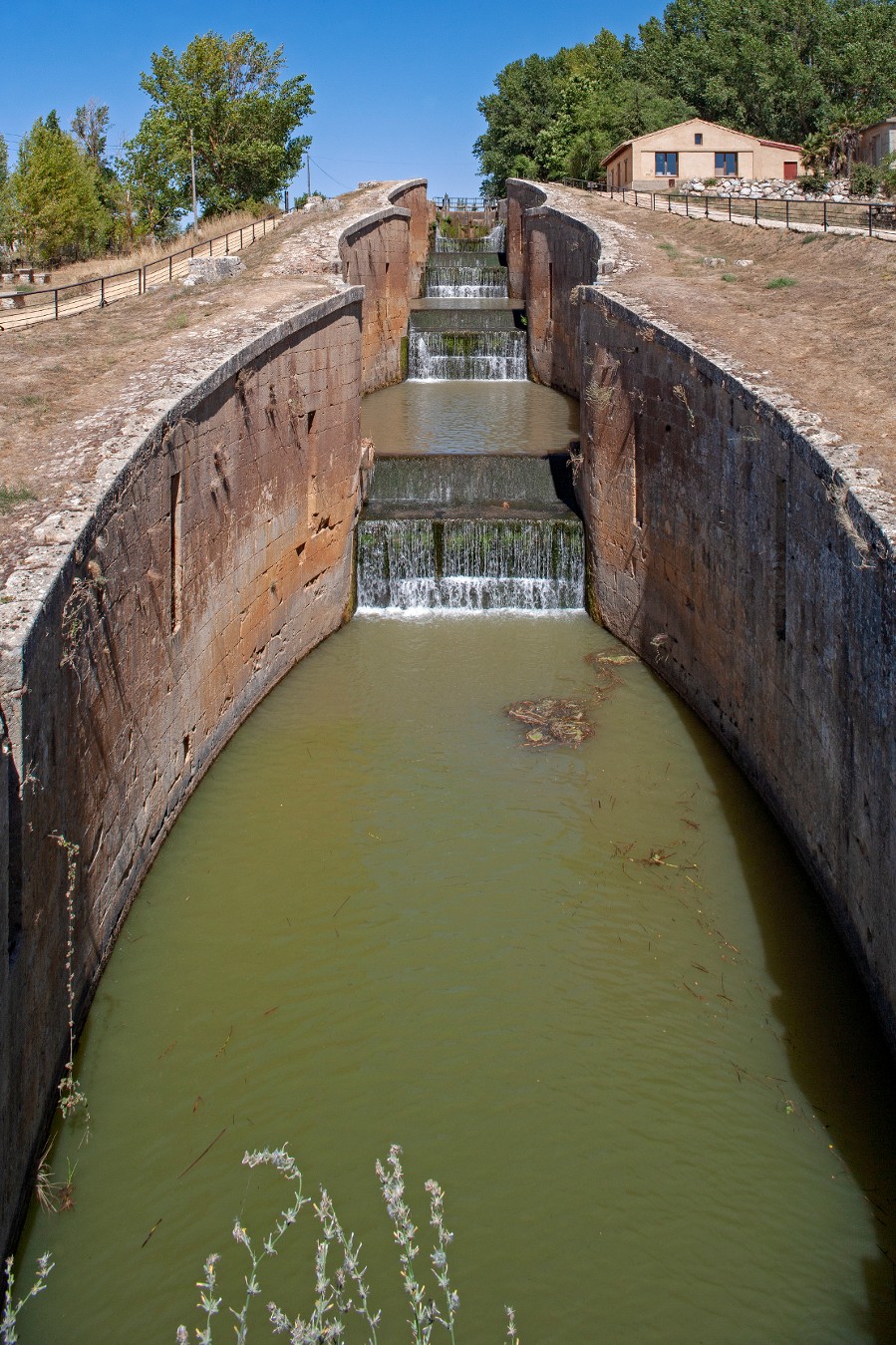
Among the most important constructions of the Canal de Castilla there are the sluices. Their purpose was to avoid the unevenness of the ground as well as ease the navigation. They were additionally used to join two different sections of the Canal at different levels. The docks, constructed in stone, were used to load and unload merchandises. They are sort of ‘ports’ for this stretch of water.
Along the Canal, tourists find numerous bridges and a total of sixty-nine aqueducts, of varying size and length, as the Vallarna aqueduct or the aqueduct of Ucieza River, through which the barges navigated (at one time the number of barges managed to exceed 300) to transport merchandises along the Canal. On the other hand, dams and retentions were those that adjusted the bed of the Canal when it reached the Pisuerga and the Carrion Rivers.
History of the Canal
Although the idea to create a network of navigation channels had already been put forward in the 16th century, it was not until 1751 that it began to take shape when the Marques de la Ensenada requested it of Fernando VI.
The preliminary designs were done by Antonio Ulloa under the supervision of Carlos Lemaur. This French engineer had already worked on a project to build 7 canals. Ulloa, in 1753, drew up the so-called ‘Proyecto General de Navegacion y Riego’ para los Reinos de Castilla y León. The project included the construction of 4 canals, the 3 that exist today and a 4th one, the Canal de Segovia, which would have its source in the river Eresma and would flow into the river Duero at Villanueva de Duero.
How to walk the Canal
One of the best ways to appreciate the nature, fauna and landscape that this area has to offer, is on foot.
It will take several days to cover the 200km distance that makes up the 3 branch roads of this route. Walking on average 25km or 30km per day, will be enough to complete the route in just under 8 days and enable hikers to enjoy the wonderful sights along the Canal de Castilla as well as the villages they pass through. All along the route various posters providing information on the different elements (docks, sluices, aqueducts etc...) of the route will appear. However the Canal is the best way to discover what there is to discover.
The Canal route can be done at any time of year. However, the best time is spring and summer. It is important to wear suitable clothing and to travel light. A raincoat in case of the odd shower and a cap for the sun are two recommended items.
Lock No. 10 Canal de Castilla
Standing on the Castilla Canal, visitors can admire the Lock No. 10, a superb example of hydraulic engineering. One of the major feats of Spanish civil engineering in the 18th and 19th centuries, it was built to link the interior of the Iberian Peninsula with the North and to transport the wheat grown in Castile.
The idea was first put forward in Spain by Bartolomé Bustamante in 1549, receiving the support of Ferdinand VII, yet it was not until 1735 that a project, under the name ‘A General Project for Navigation and Irrigation Canals for the Kingdoms of Castilla y León’, was drawn up for the construction of four canals in Spain. Although the appearance of the railways prevented the project from being completed, it did provide essential irrigation canals for agriculture. Other sites of interest include the churches of San Bartolomé and San Martín and La Campesina Bridge.