Route 1: Barruelo de Santullán - Balboa Cacabelos - Balboa
Stage 13 belonging to Route 1: Barruelo de Santullán - Balboa
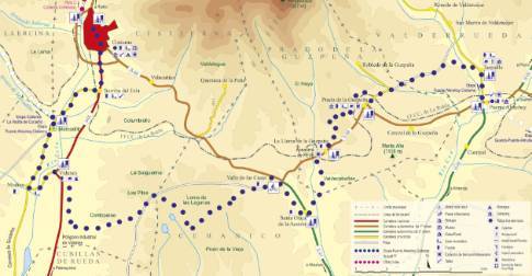
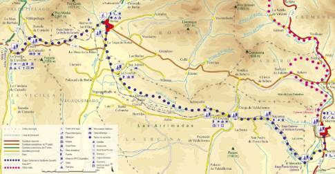
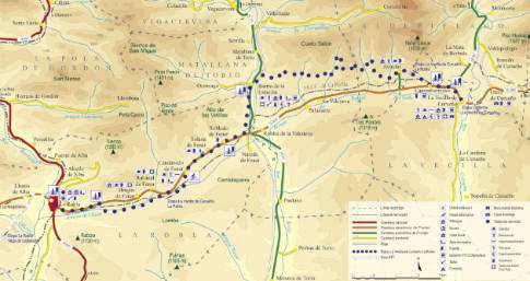
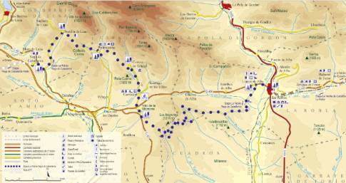
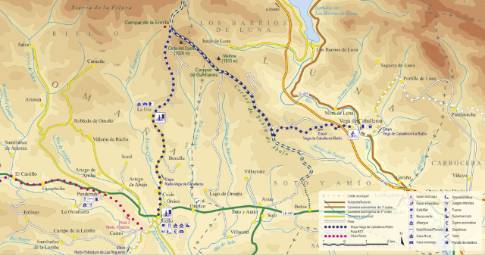
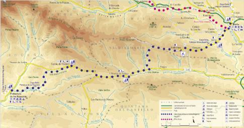
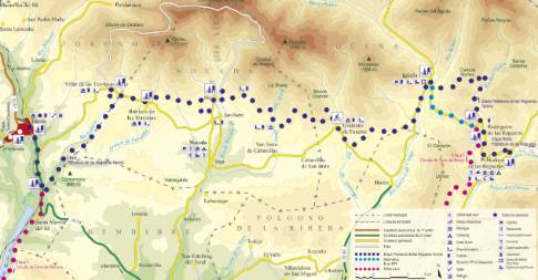
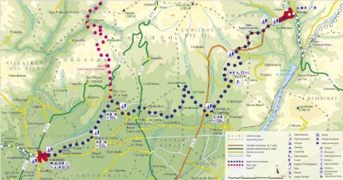
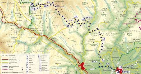
Linear route 41 km long and an estimated duration of 3 hours 25 minutes with a gradient of 784 meters. Forest track (28%) and road (72%). High difficulty. Recommended time: spring to autumn; In the winter you can find sections in poor condition due to rain and, occasionally, snow.
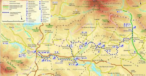
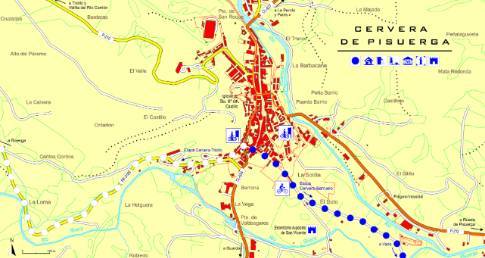
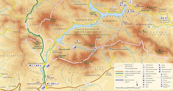
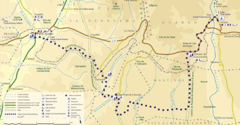
Route map
 High resolution image. This link will open using lightbox, there may be a context switch
Tips and recommendations
The stage includes long journeys along secondary and local roads with little vehicle traffic, despite which it is mandatory to drive on the right side and with caution. Special care is recommended at intersections and sections where the route crosses or circulates on more important roads.
Points of interest
Valtuille de Arriba has a name of French origin (Valt d'huille), which means "valley of olive trees."
Discover it as you pass through {0}
- Cela
From Cela to Balboa LENGTH: 15.7 km. DURATION: 1 hour 30 minutes. SLOPE: 572 m. TYPE OF ROAD: forest track (52%) and road (48%). DIFFICULTY OF THE SECTION: high. RECOMMENDED TIME:...
- Departure from Balboa
The route begins in Balboa with a tough road climb to Cantejeira. This pretty village, with its last pallozas, is crossed from side to side to continue the climb along a forest track that leads to the...
- Campa de las Vigas
From Campa de las Vigas to Balboa LENGTH: 30.4 km. DURATION: 2 hours 30 minutes. SLOPE: 647 m. TYPE OF ROAD: forest track (27%) and road (73%). DIFFICULTY OF THE SECTION: high.
- Sotelo
From Sotelo to Balboa LENGTH: 13.5 km. DURATION: 1 hour 25 minutes. SLOPE: 572 m. TYPE OF ROAD: forest track (60%) and road (40%). RECOMMENDED TIME:...
- Cantejeira
From Cantejeira to Balboa LENGTH: 5.2 km. DURATION: 20 minutes. SLOPE: 395 m. TYPE OF ROAD: forest track (100%). DIFFICULTY OF THE SECTION: low. RECOMMENDED TIME: all year round.
- Paradaseca
From Paradaseca to Balboa LENGTH: 20.7 km. DURATION: 1 hour 50 minutes. SLOPE: 572 m. TYPE OF ROAD: forest track (39%) and road (61%). RECOMMENDED...
- Departure from Cacabelos
Crossing the bridge over the Cúa River, the route leaves Cacabelos along the Villafranca del Bierzo road. Immediately you cross the town of Pieros, while ascending a slope between vineyards that gives...
- Valtuille de Arriba
From Valtuille de Arriba to Balboa LENGTH: 36.1 km. DURATION: 3 hours 5 minutes. SLOPE: 697 m. TYPE OF ROAD: forest track (32%) and road (68%). DIFFICULTY OF THE SECTION: high.