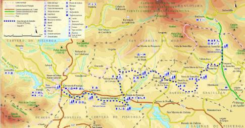
Route 1: Barruelo de Santullán - Balboa Cervera de Pisuerga - Triollo
Stage 2 belonging to Route 1: Barruelo de Santullán - Balboa
Linear route of 24.3 km in length and an estimated duration of 2 hours 10 minutes with a gradient of 450 meters. Forest track (38%) and road (62%). High difficulty. Recommended time: spring to autumn; In winter there may be sections closed with snow on the route between Rebanal de las Llantas and Alto de La Varga.
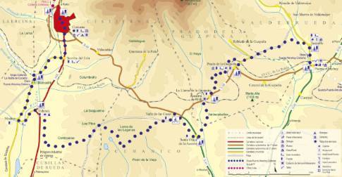
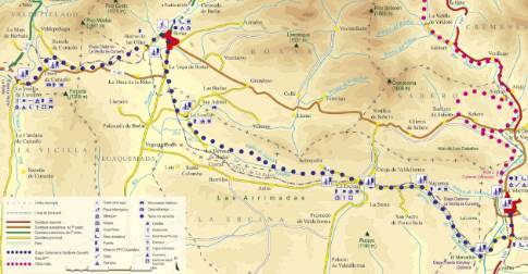
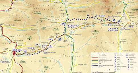
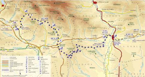
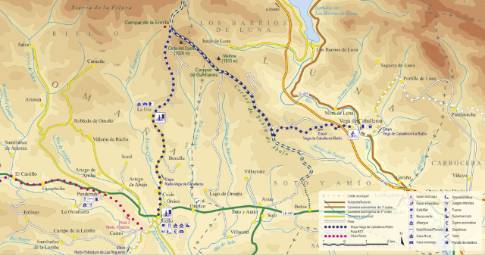
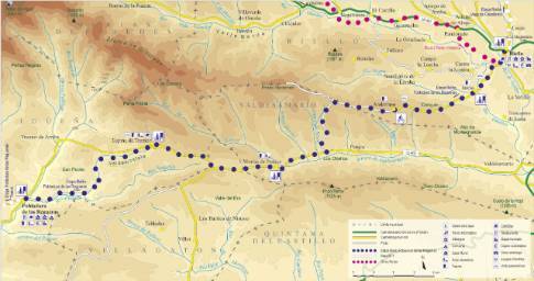
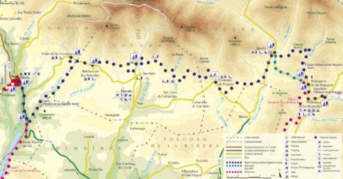
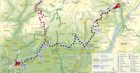
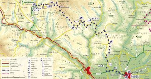
Route map
 High resolution image. This link will open using lightbox, there may be a context switch
Tips and recommendations
This stage crosses high areas, where the rigors of the climate can be very pronounced at any time of the year. Therefore, it is advisable to be prepared for unexpected weather changes (fog, rain, cold, strong sunshine).
It is recommended to replenish the canteen at the town fountains.
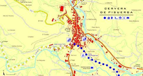
Discover it as you pass through {0}
- Departure from Cervera
Leaving Cervera along the Ruesga local road, the route goes up the Rivera River valley to the Ruesga reservoir, on whose banks there is a recreation area that is very popular in the summer. From there,...
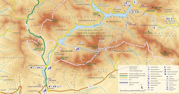
- Departure from Triollo
Leaving Triollo along the so-called Carretera de los Pantanos, the stage begins with the ascent of Alto La Varga (1,435 m), a route that passes through the town of La Lastra. Once you have reached the...
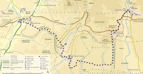
- San Martín
From San Martín to Triollo LENGTH: 11.8 km. DURATION: 1 hour. SLOPE: 360 m. TYPE OF ROAD: forest track (30%) and road (70%). DIFFICULTY OF THE SECTION: high. RECOMMENDED TIME: from...
- Rebanal
From Rebanal to Triollo LENGTH: 8.7 km. DURATION: 50 minutes. SLOPE: 310 m. TYPE OF ROAD: forest track (53%) and road (47%). DIFFICULTY OF THE SECTION: high. RECOMMENDED TIME: from...
- La Lastra
From La Lastra to Triollo LENGTH: 1.7 km. DURATION: 5 minutes. SLOPE: 80 m. TYPE OF ROAD: road (100%). DIFFICULTY OF THE SECTION: low. RECOMMENDED TIME: from spring to autumn. Between...
- Ventanilla
From Ventanilla to Triollo LENGTH: 15.2 km. DURATION: 1 hour 15 minutes. SLOPE: 395 m. TYPE OF ROAD: forest track (25%) and road (75%). DIFFICULTY OF THE SECTION: high. RECOMMENDED...
- Ruesga
From Ruesga to Triollo LENGTH: 21 km. DURATION: 1 hour 55 minutes. SLOPE: 425 m. TYPE OF ROAD: forest track (43%) and road (57%). DIFFICULTY OF THE SECTION: high. RECOMMENDED TIME:...
- Alto La Varga
From Alto La Varga to Triollo LENGTH: 4.7 km. DURATION: 10 minutes. SLOPE: 140 m. TYPE OF ROAD: road (100%). DIFFICULTY OF THE SECTION: low. RECOMMENDED TIME: spring to autumn.